Currently I try to develop and apply a deep learning model to detect vessels. I imported aerial imagery (3 bands, Color Infrared, 25 cm resolution, ECW files) and created manually about 200 training samples of ships. As software I used Arc GIS Pro in combination with Jupyter Notebook.
I exported the training samples to image chips and trained a model with 78% accuracy which looks promising.
As a last step I used the 'Detect Objects for Deep Learning' tool to apply my model. Results are shown in the image below:
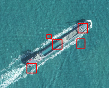
Did I something wrong that I get different predictions for actually one individual ship?
I hoped to get something like this:
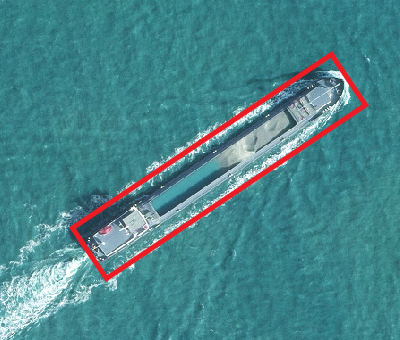
Any suggestions how could I improve my results? Thanks in advance for your help!


