Hello Everyone!
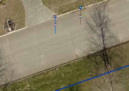
I am currently in the last few weeks of my internship with a GIS city group, my supervisor has introduced me to the Water Utility Editing Tools and its features. I have been tweaking the config file to match our layer names and everything, but cannot get the "Add Laterals From Line Locations" tool to work properly. When I select a water meter and the main water line, the tool will run and produce a connecting line that only makes it roughly halfway to the main line. Here are a couple of images to hopefully clear any confusion:
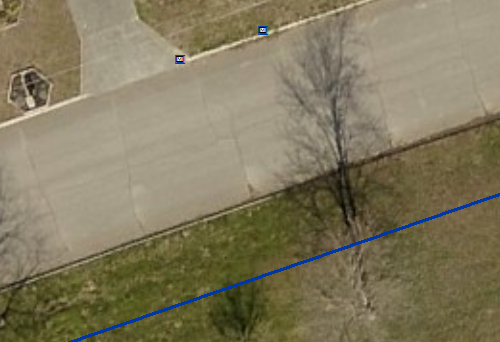
Here you can see two test water meters with a mainline across the street:
After selecting BOTH the meter and the main line, I am given this after running the "Add Laterals From Line Locations" Tool:
I am curious if anyone has encountered this problem before and/or might be able to give me insight to a solution?! Any help would be greatly appreciated and let me know if you need me to provide any more information such as the Config file I have setup.
Thanks ahead of time!



