
CHAPTER 1: MISSION
Introduction
This chapter outlines how implementing a geospatial strategy and geospatial support system can enhance the mission of educational institutions. It establishes an overarching vision of how to govern GIS technology to support teaching, learning, research, and administration.
Mission
Higher education institutions aim to develop and apply knowledge through teaching, learning, research, and public engagement. This includes educating students, solving societal challenges through research, and contributing to society through public service. At the core, this mission is about fostering literacy, encouraging learning and discovery, and solving societal problems.
Geospatial technology encompasses tools, workflows, and techniques used to capture, analyze, and visualize location-based data. It can advance the mission of educational organizations in a variety of ways:
- Enhances education and learning objectives through spatial thinking and geospatial literacy
- Advances research through innovative geospatial analysis and visualization
- Supports service and civic engagement through data sharing and community engagement capabilities
- Promotes personal and professional development through geospatial skills applicable to any area of interest
- Improves institutional operations through location-aware decision-making
The following sections outline goals for institutional leaders and educators learning how geospatial technology should be perceived, managed, and governed to support the larger mission of the institution.
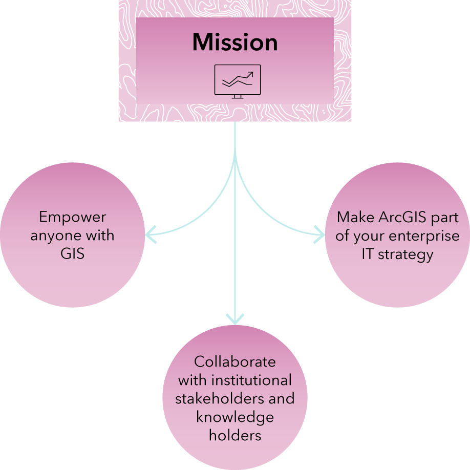
Empower anyone with GIS
Geospatial technology can help solve some of the world’s toughest problems by showing how and where to act. All fields–engineering, history, public health, business, anthropology, and more–require the ability to gather, visualize, analyze, and present information in a spatial context.
GIS should be considered an institutional resource, not a departmental tool. This means that the potential user base could be all students, faculty, and staff. While some academic disciplines are more obviously geospatially intensive, such as geography and environmental science, any discipline can use GIS.
Make ArcGIS part of your enterprise IT strategy
GIS is an evolving enterprise technology and should be viewed and managed accordingly. This system encompasses capabilities, software, data, technology infrastructure, people, and workflows that fulfill specific needs and help solve complex spatial problems—providing value to many departments and disciplines.
ArcGIS is an enterprise system that includes cloud, on-premises, mobile, desktop, and developer components. It is important that it is integrated into your institution’s broader enterprise IT strategy. It requires a governance approach that includes access, availability, lifecycle management of users and data, maintenance, and communication.
In addition, governance is not just about technology itself but also how you implement, collaborate, integrate, and work across various systems and policies on campus. The maintenance of this GIS system requires alignment with existing policies and guidelines that an institution has in place to handle data and users and comply with existing access, security, and privacy policies.
Collaborate with institutional stakeholders and knowledge holders
Effective use of ArcGIS technology requires collaboration across institutional constituents, including IT, GIS professionals, administrators, faculty, researchers, and students who manage and use this system.
Implementing and maintaining such a system requires a diverse set of skills that no one person may possess. It requires staff with enterprise IT skills to integrate it with other authoritative systems, such as identity and access management (IAM or SAML), and to comply with institutional policies and guidelines. It requires staff with enterprise administration skills to understand the operation of GIS at scale—for example, in software as a service (SaaS) or on-premises deployments. It may require GIS skills from those doing common GIS functions and tasks, such as mapping and visualization, spatial analysis, sharing, and presenting. It may require programming skills from those employing automation and application development. However, with these in place, the broader campus community may not need IT or GIS skills at all to use geospatial technology in their teaching, learning, research, and administration.
Collaboration among various constituents is key to successfully deploying, managing, and maintaining this system across roles and departments. This collaboration involves stakeholders in GIS, enterprise IT, and administration, as well as faculty, staff, and students.
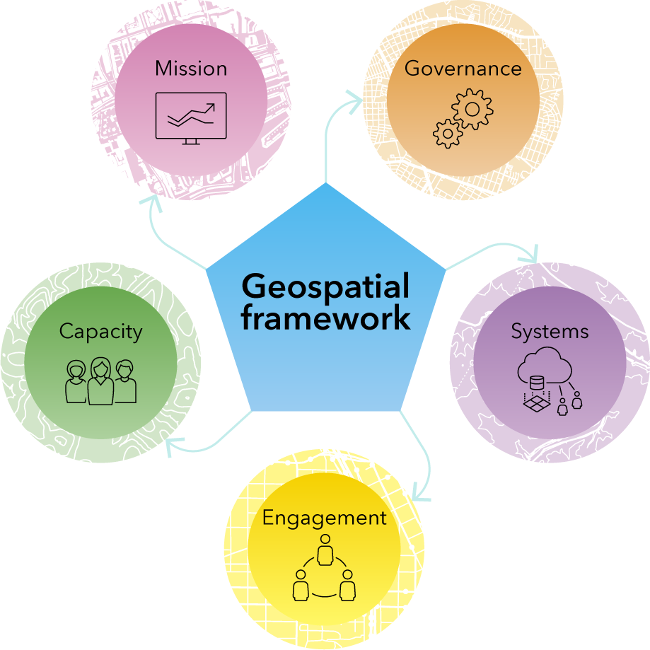
Geospatial framework: A path to geospatial excellence
Having a mission-driven, structured geospatial governance framework is required. Geospatial governance is a formal approach to creating policies, guidelines, and responsibilities that determine how your educational institution implements and supports GIS, including data, applications, processes, capabilities, and resources.
Through a geospatial framework, you can manage change by building trust, creating ownership and accountability, valuing the organization’s intellectual property, and upholding best practices and standards.
Building a geospatial framework consists of five key steps:
- Align educational mission with a geospatial strategy that establishes a vision for GIS.
- Establish policies, guidelines, and procedures for effective governance of GIS.
- Implement a modern and robust geospatial system.
- Engage teams in planning, communication, monitoring, and collaboration around GIS efforts.
- Equip stakeholders with the knowledge, skills, and resources to manage GIS at a sustainable capacity.
Conclusion
Geospatial technology can enhance a higher education institution’s mission of teaching, learning, and research, benefitting many stakeholders across disciplines and departments. Modern GIS requires deployment, management, and maintenance by skilled professionals as well as alignment with institutional policies and guidelines, achieved by collaboration between various stakeholders.
Now that you know how geospatial thinking and technology can support your institutional mission, you can set policies to guide ArcGIS governance, systems, engagement, and capacity.
Next Steps
Read the rest of the chapters:
E-book PDF will be available soon.
Contact your Account Manager or highered@esri.com with any questions.
