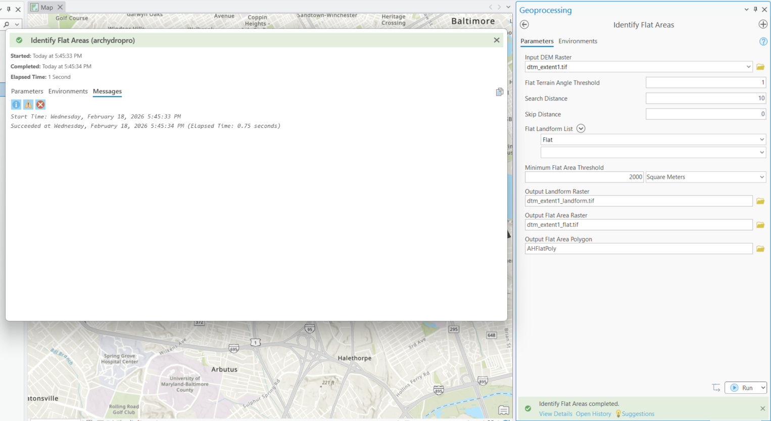
Ik probeer een overstromingsdiepte-raster te maken zodat ik de Flood Impact Analysis Solution (FIAS)-toolset kan gebruiken in mijn waterdistrict. Ik volg het Creating Flood Depth Rasters for Flood Impact Analysis <\/A> richtlijnen document, maar ik loop vast bij het gedeelte over het adresseren van vlakke gebieden. Wanneer ik de Arc Hydro Identify Flat Areas-tool uitvoer op de voorbeeld DEM die zij leveren, voltooit de tool succesvol, maar er worden geen rasters of lagen gegenereerd. Ik gebruik ArcGIS Pro 3.6.1.<\/P><\/span><\/P> <\/P>Identify Flat Areas=====================Toolpad<\/P>Input DEM Raster dtm_extent1.tifFlat Terrain Angle Threshold 1Search Distance 10Skip Distance 0Flat Landform List FlatMinimum Flat Area Threshold 2000 SquareMetersOutput Landform Raster C:\LOCATION\ArcHydro\FIAS\Layers\dtm_extent1_landform.tifOutput Flat Area Raster C:\LOCATION\ArcHydro\FIAS\Layers\dtm_extent1_flat.tifOutput Flat Area Polygon C:\LOCATION\ArcHydro\FIAS\FIAS.gdb\Layers\AHFlatPoly=====================Berichten<\/P>Starttijd: woensdag 18 februari 2026 17:45:33Geslaagd op woensdag 18 februari 2026 17:45:34 (Verstreken tijd: 0,75 seconden)<\/P>
<\/span><\/P> <\/P>Identify Flat Areas=====================Toolpad<\/P>Input DEM Raster dtm_extent1.tifFlat Terrain Angle Threshold 1Search Distance 10Skip Distance 0Flat Landform List FlatMinimum Flat Area Threshold 2000 SquareMetersOutput Landform Raster C:\LOCATION\ArcHydro\FIAS\Layers\dtm_extent1_landform.tifOutput Flat Area Raster C:\LOCATION\ArcHydro\FIAS\Layers\dtm_extent1_flat.tifOutput Flat Area Polygon C:\LOCATION\ArcHydro\FIAS\FIAS.gdb\Layers\AHFlatPoly=====================Berichten<\/P>Starttijd: woensdag 18 februari 2026 17:45:33Geslaagd op woensdag 18 februari 2026 17:45:34 (Verstreken tijd: 0,75 seconden)<\/P>
We have found that trying to drop a .tif into the GDB does not work! Create a separate folder and change the default path for output to it.
Yes it is, thank you. Reinstalling did not seem to fix the issue. I did notice that the installation file states ArcHydroToolsforArcGISPro3.5.msi, so I am wondering if this is a versioning issue, since I am running ArcGIS Pro V3.6.1.
Arc Hydro Tools Downloads for ArcGIS Pro & ArcMap
Downloading and Installing Arc Hydro Tools | 2023
hoping this is the download link access point
Hi Dan,
Thanks for your response. When I run the tool, no files are generated. I've checked the output locations and nothing appears, and nothing is added to the ToC.
Unfortunately, the AH download link that Dean shared in his response to the other post is broken. I will try to re-download my version of AH to see if that fixes anything.
Are results automatically added to display for geoprocessing tools?
Have you confirmed that the 2 *.tif files don't exist in the output folders?
If they do exist and they are listed in the map's table of contents, do a right-click on one of the layers and zoom-to-layer (maybe a different ill-defined coordinate system)
Also... a related thread Arc Hydro Characterize DEM - Flat Area Raster step... - Esri Community
Aangemelde leden kunnen berichten plaatsen, updates volgen en meer. Nieuw hier? Registreer een gratis account.
Find useful guides, FAQs, and documents to help you navigate and make the most of Esri Community.