Can someone help me understand what I'm doing wrong when trying to call the CreateLasDataset geoprocessing tool? I have trouble with calling the geoprocessing tools in general, this is for C#.
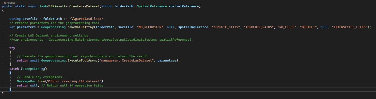
Here is my current helper method to call the create lasdataset geoprocessing tool.
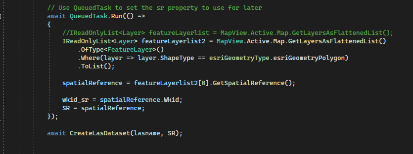
I set up the tool and extract the spatial reference from an existing layer within the map then call the helper method here in this code snippet below. Note, I also extract the wkid, maybe I should use this instead and get the spatial reference within the createlasdataset helper method?
When I run the tool manually, then copy and past the arcpy command I get this result, my thinking was to recreate this order of parameters but I'm not having much luck. I highlighted the spatial reference to try and make this easier to read.
arcpy.management.CreateLasDataset(r"G:\GS\Projects\Reil_Delivery\ArcProAddins\SchulerSwathTool\lasfilelocation", r"G:\GS\Projects\Reil_Delivery\ArcProAddins\SchulerSwathTool\lasfilelocation.lasd", "NO_RECURSION", None, 'PROJCS["NAD_1983_UTM_Zone_12N",GEOGCS["GCS_North_American_1983",DATUM["D_North_American_1983",SPHEROID["GRS_1980",6378137.0,298.257222101]],PRIMEM["Greenwich",0.0],UNIT["Degree",0.0174532925199433]],PROJECTION["Transverse_Mercator"],PARAMETER["False_Easting",500000.0],PARAMETER["False_Northing",0.0],PARAMETER["Central_Meridian",-111.0],PARAMETER["Scale_Factor",0.9996],PARAMETER["Latitude_Of_Origin",0.0],UNIT["Meter",1.0]]', "COMPUTE_STATS", "ABSOLUTE_PATHS", "NO_FILES", "DEFAULT", None, "INTERSECTED_FILES")
Could someone help me understand how to do this correctly? This is my first time asking a question like this, I'm unfamiliar with how to format properly.


