Hello all,
I'm stumbling upon a challenge. My aim is to change some areas within the Land Use/Land Cover (LULC) raster that I'm currently using, but I have no idea how. Allow me to visualize the situation to make my issue a bit more clear.
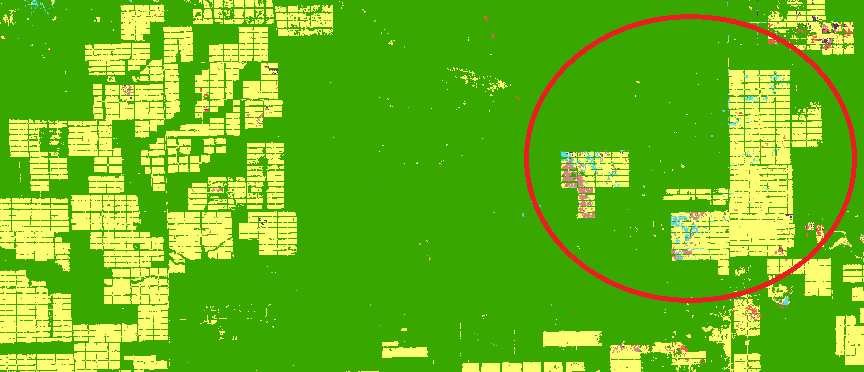
So this map shows forests (green, obviously) and pastures for cattle (yellow). The pastures in the red circle are planned to be converted into a more sustainable type of cattle ranching. My aim is thus to give these sustainable pastures a different value (not green, not yellow, but lets say brown). How can I use ArcGIS Pro to change my current LULC raster and add a new value to a specific geographical area/specific pixels? Is this even possible at all?
Thank you in advance!

