I am working on a python script and am referencing a living atlas layer for FEMA flood hazard data. The script works great, as along as add the FEMA Flood Hazard data from living atlas into my map, then into my tool. However, I would really like this script to work with the FEMA layer referenced as the default. I tried this in the python script itself with the service URL, but was unsuccessful.
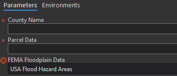
My alternative option was to use it in the tool properties dialog. I am able to add it as a default, however when I open the tool, I am given the red X. Am I missing something, or is there a work around to reference a living atlas layer in the python script itself, or use it as a parameter's default?
Screenshots below

Thanks!



