Hello!
Trying to create a survey to enter maritime/marine navigational warnings. The struggle point - providing an interface for the form-filler/user to enter specific lat/long coordinates for things like rocket launch zones (an area) or a boat parade route (a line.) The vertex method is getting me closer to what I need, but not close enough as I can't figure out how to expose and edit the coordinates for the vertices that have been laid down.
For a recent example in the news, let's pretend I was trying to create the launch hazard (a fictional one) area for the recently launched and blown up rocket launch from South Texas:
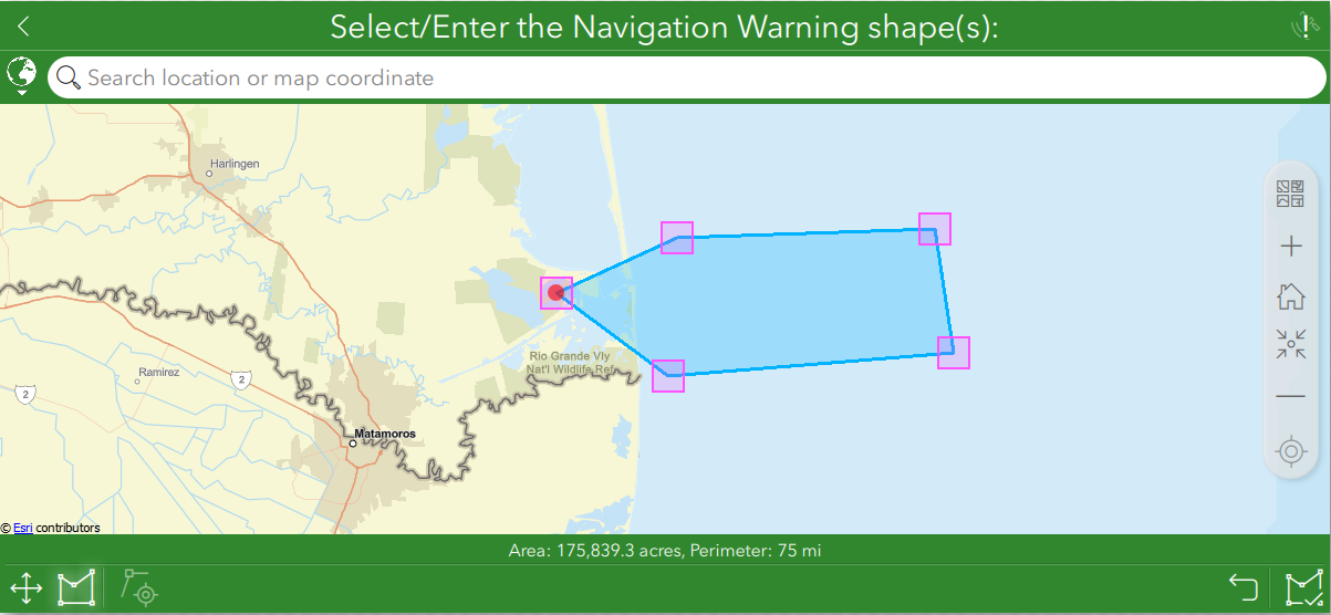
Now, the coordinates for these 5 fictitious points are actually listed in regulation and need to reflect the exact Lat/Long in the regulation. "Eyeballing it" is completely unsatisfactory since this data, after it creation, is intended to be shared with the maritime public.
I'm assuming/hoping that there is some parameter that I could set in my Survey123 Connect form (attached) to somehow turn on an option that would enable XY fields to appear so that the Lat/Long could be manually edited to match the positions published in regulations (or in the case of some commercial space areas, are provided by literal rocket scientists for dissemination to maritime interests as they get closer to launch day.)
I hope I explained my conundrum well enough to make sense. Hoping someone knows a solution because I've googled and read a lot and still can't seem to conquer this short coming.
Thanks for coming to my Ted talk,
Amilynn



