Hello! I have a points feature class (named "BR_RG_Imediatas_2021_MeanCenter"), in which I used the tools "Create TIN" and "TIN Edge" to create an edge feature class (named "SC_TIN_TinEdge") that connects these points using Delaunay Triangulation. Please refer to the picture below.
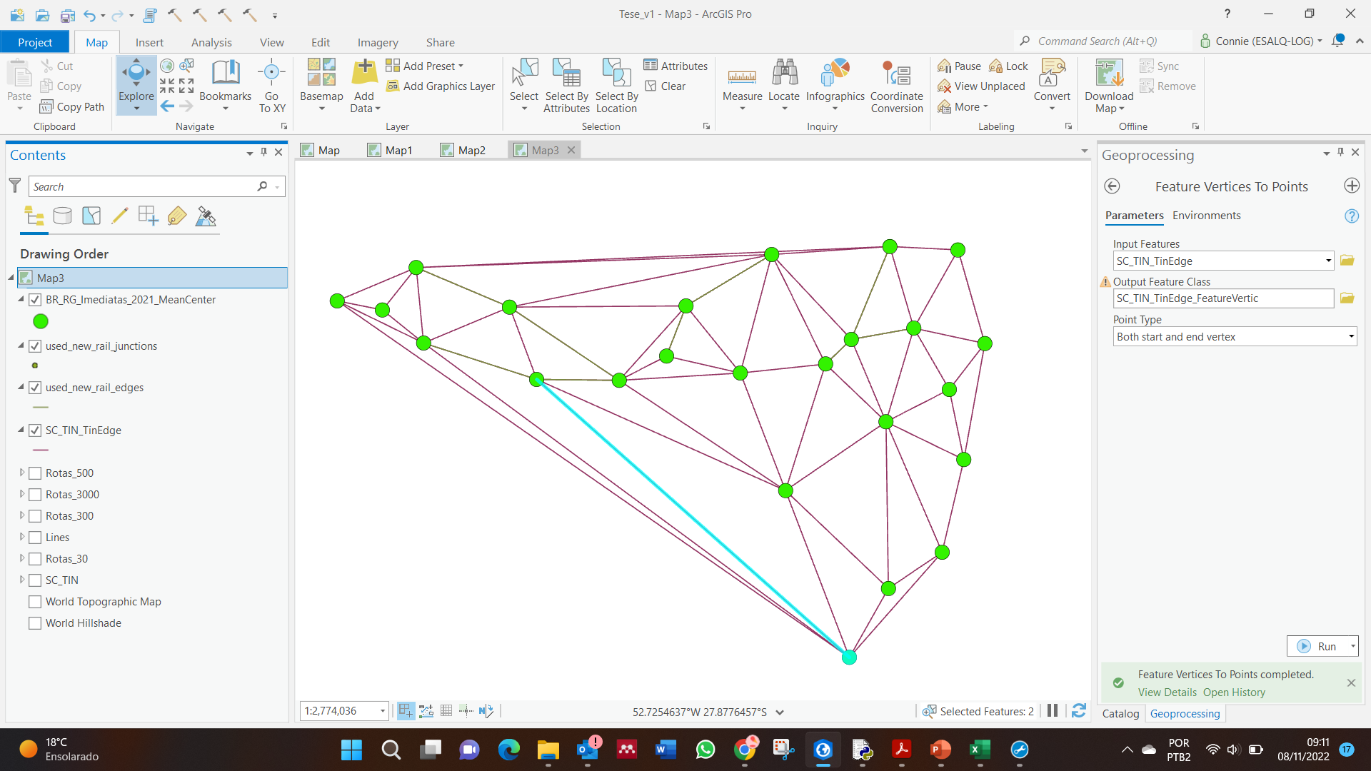
The edges represent railway stretches and the points represent railway terminals. I need to build an heuristic, in which I'm going to select some edges and points, representing a new railway, and then I'm going to build the network dataset and run the route solver.
To build the heuristics' solution, I was thinking of creating two fields in the "SC_TIN_TinEdge" edges feature, one with the edge's start point ID and another field with the edge's end point ID in the "BR_RG_Imediatas_2021_MeanCenter" points feature. with this information, I know which edges are connected.
For instance, the first edge (OBJECTID=1) starts with the point with OBJECTID=4 and ends with OBJECTID=10. The second edge (OBJECTID=2) also starts with the point with OBJECTID=4, but ends with point OBJECTID=5 (please refer to the pictures below).
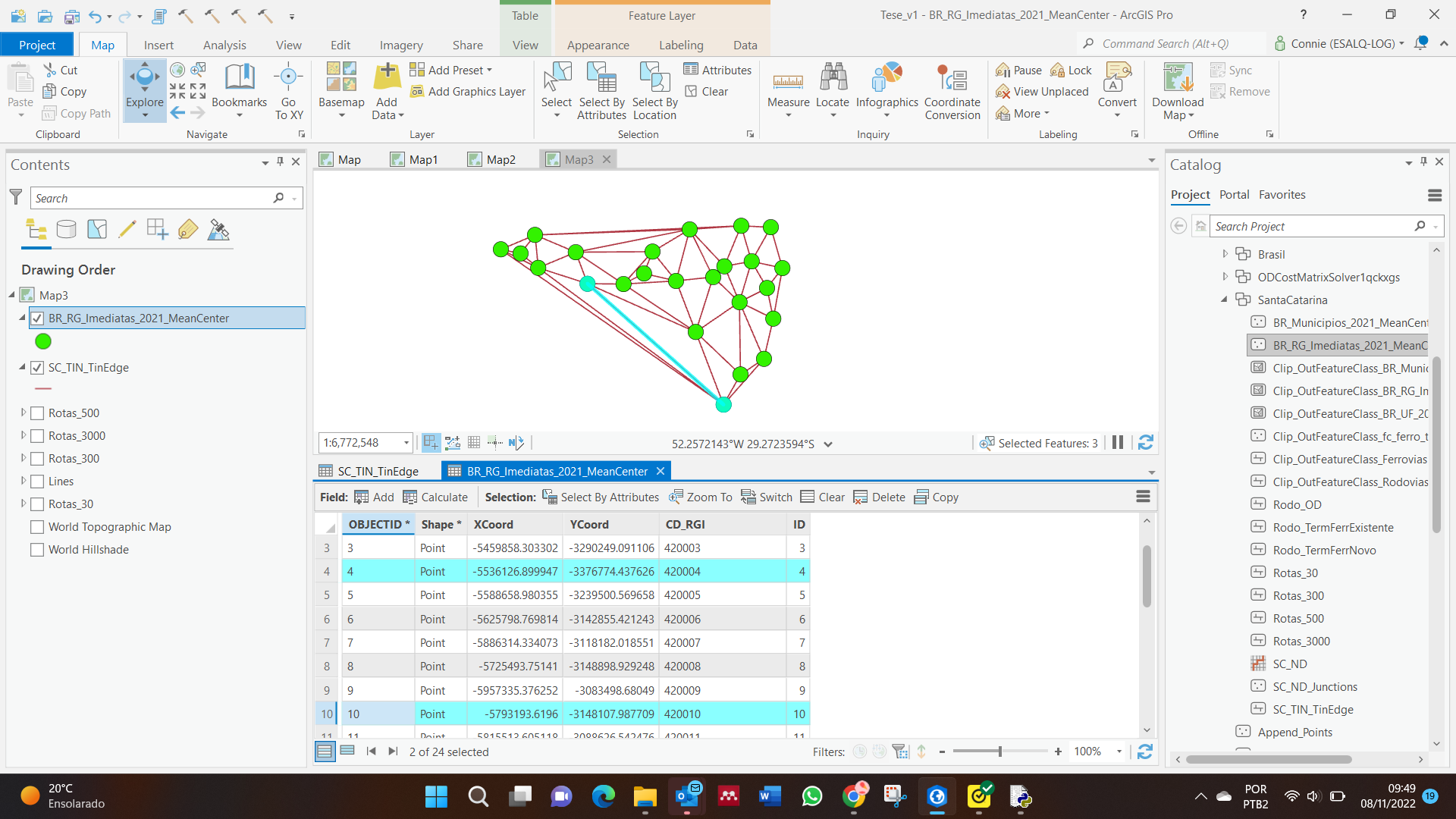
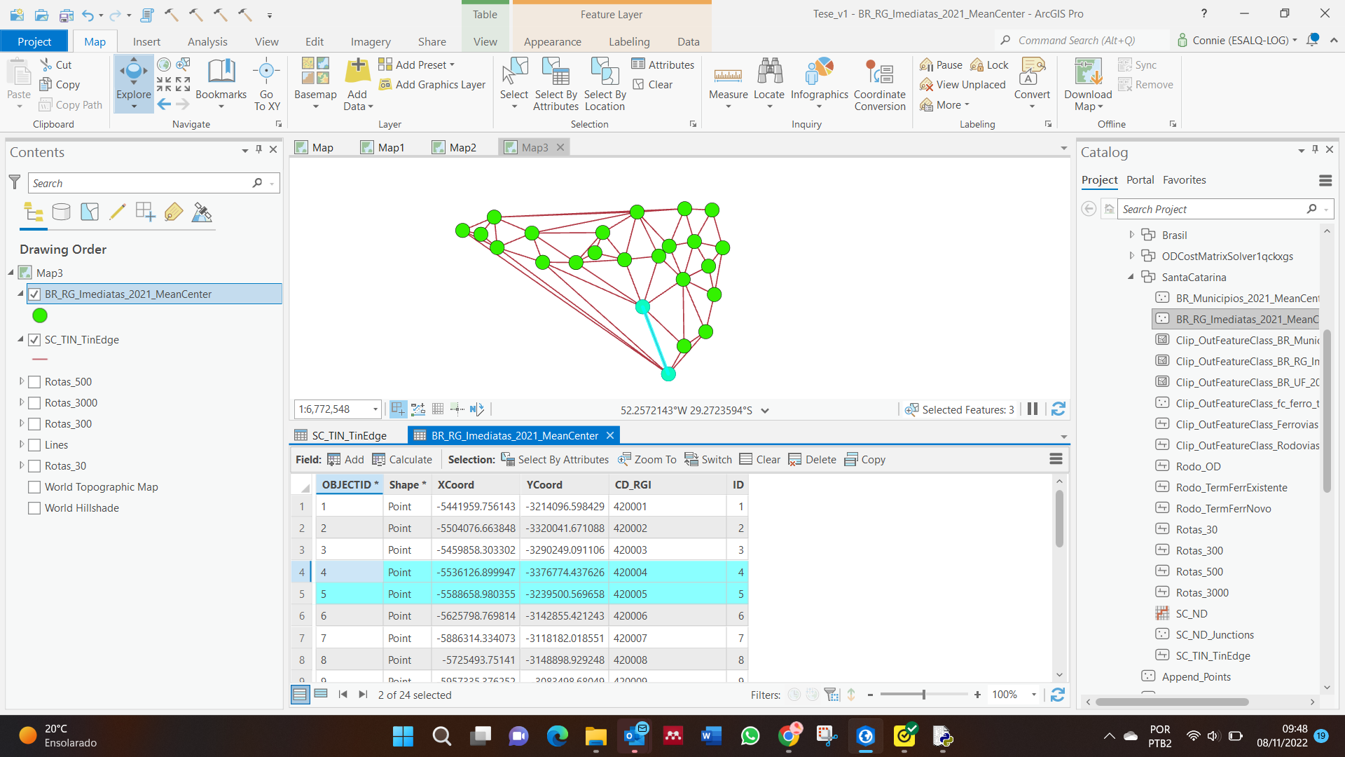
Please, do you know hw can I create these two points' ID fields in the edges feature class in an automatic way?
Thanks and regards!

