Hi there, I recently use ArcGIS Experience Builder to create an app: https://experience.arcgis.com/experience/9e22a450ffb44d6f96451cf70fe02298/page/Flood-Hazard/?views=Share
On the Heat Hazard tab of the app, users have the option to turn on a KML layer showing the land surface temperature. However, this layer is cut off into two parts and cannot line up with the basemap for some reasons (as shown in the screenshot below). I have tried to reproject the layer to have the same coordinate system as the basemap but it didn't help.
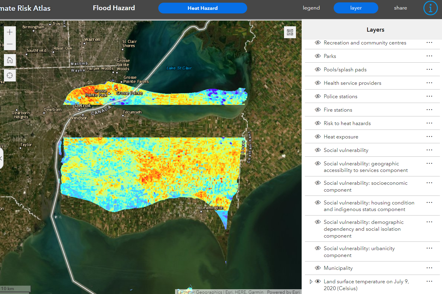
But when I opened the web map which the app uses, the exact KML layers just looks fine:
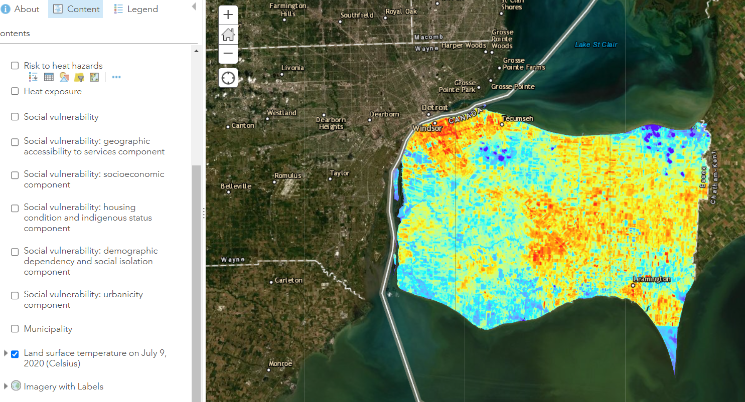
Does anyone have ideas about the possible reasons and how I can fix that? Thank you very much!




