Hey everyone,
Im trying to solve the following problem in ArcGis Pro and Im pretty certain that related tables may be the answer, but so far I‘ve had no luck in doing this on my own.
Basically I have data on borehole locations, samples taken from said boreholes and the geologic formations those samples represent. What Im trying to achieve is a table with unique entries of those geologic formations in where I select any formation, it will then highlight the boreholes on the map where samples of those formations exist. It would also be great if I could add a column to my formation list which contains all sample identifiers.
To better illustrate:
I have 3 tables boreholes/samples/formations which are build like so:
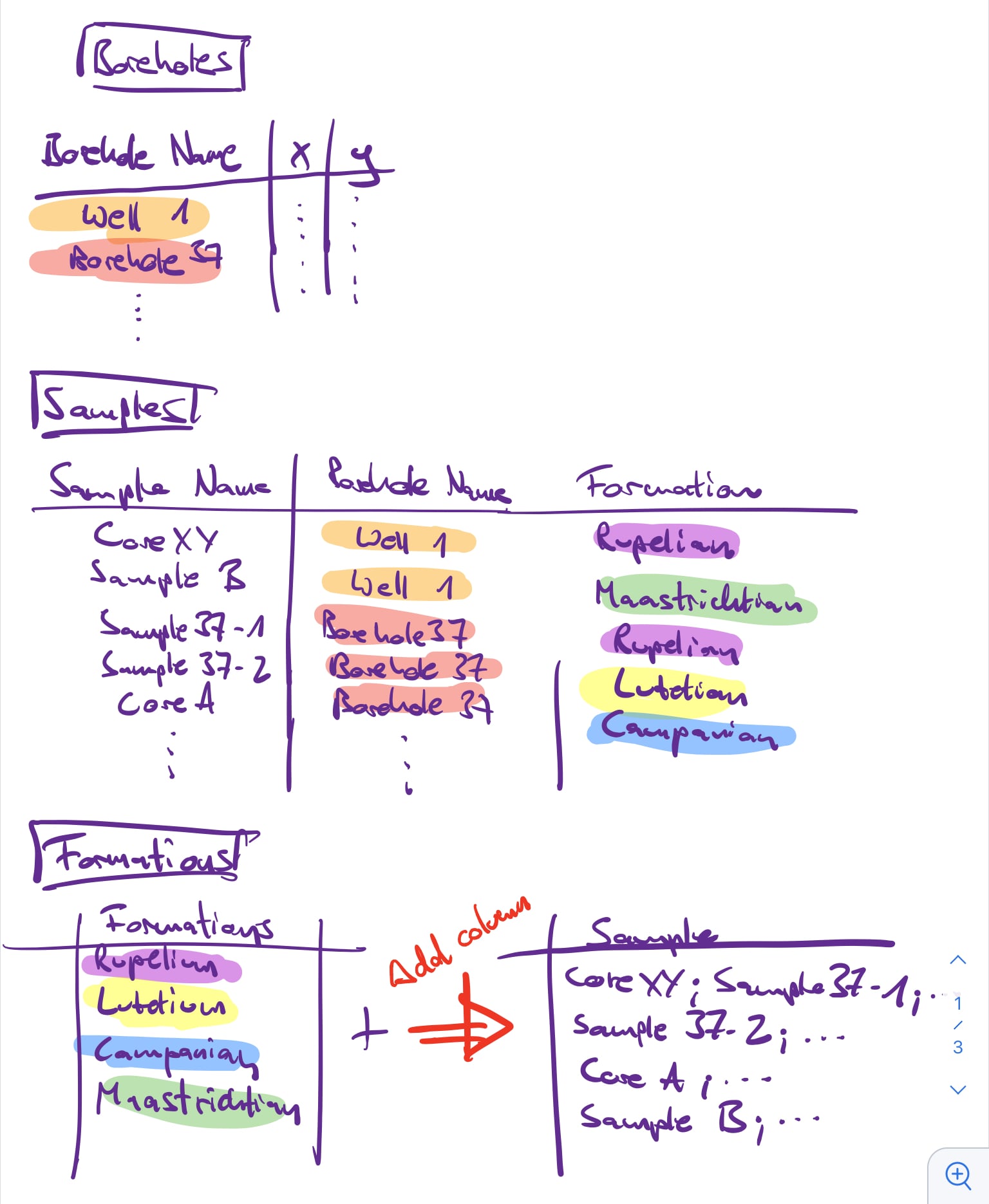
from the Borehole table I created a feature class that shows all locations on the map, now I would love to be able to easily highlight where any formations were sampled by relating the formation table to borehole locations like so:
 Any help to achieve this or maybe some idea forma workaround and which tools I should look up to do this would be greatly appreciated.
Thanks and have a wonderful weekend everybody.

