I have now tried to connect to many different WFS services and I have still not succeeded (All of them works in QGis).
I can create the connection and all the layers show in Catalog, but when I try to add to a map I get this message every time..
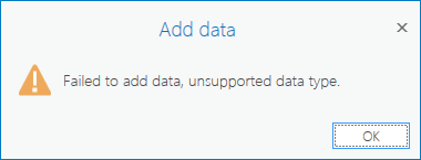
Where can I find the real error message?
Why can't I edit the connection parameters, I have to create a new connection every time?
If I use MODE = COMPATIBLE I don't get the error, but the features won't draw and polygon features seems to be recognized as points?
Does anyone know a real guide - better than the one from help?


