Hi all,
I'm trying to subset the U.S. Climate Thresholds multidimensional raster datsets (a.k.a. LOCA data) available on the Living Atlas based on this blog post: Getting started with new multidimensional climate models (esri.com).
However, in both ArcGIS Pro and ArcGIS Online, the only time value I have available seems to be 1990, even when I am working with a mid-century or late-century multidimensional raster - e.g. U.S. Climate Thresholds - LOCA RCP 4.5 Mid Century - Overview (arcgis.com).
Example:
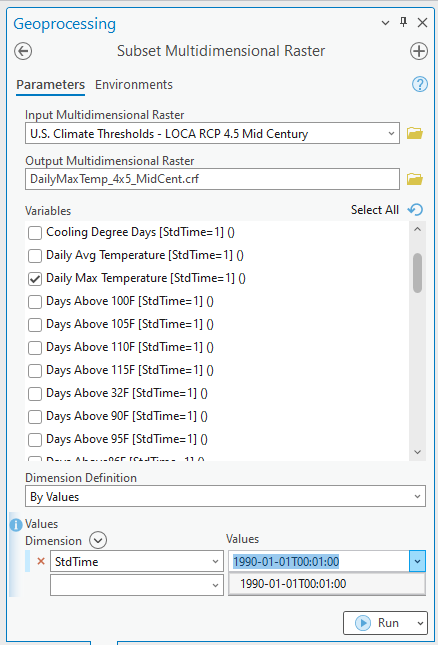
Can anyone help me understand this? Thank you in advance!




