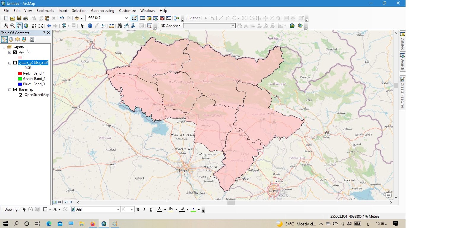
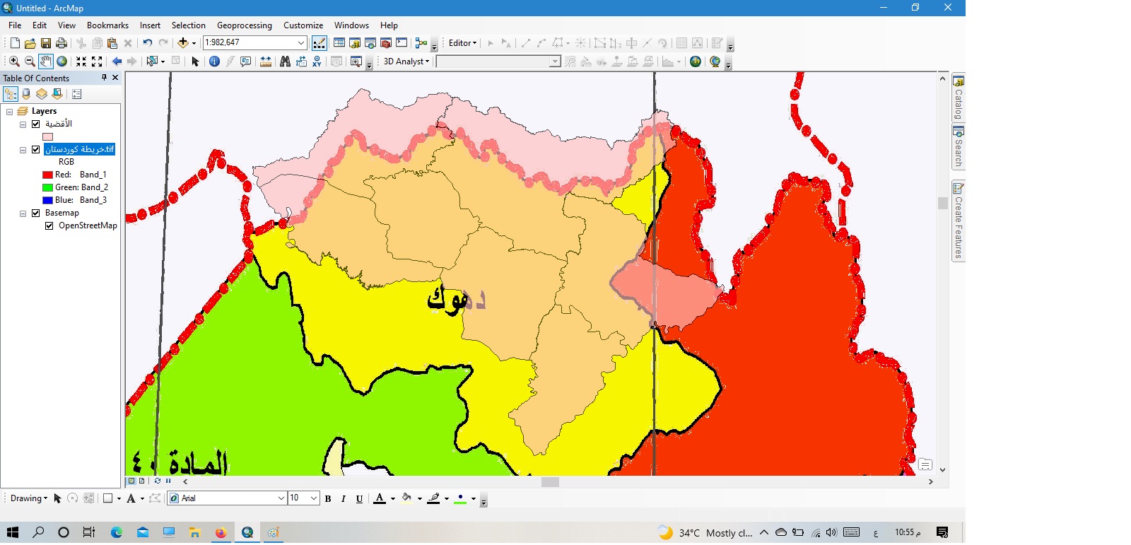
ご挨拶申し上げます。主題は地図の主題と描画の正確さについての問い合わせです。数日前に地図を描きましたが、最初の図に示されているように、プログラムのベースマップサービスに基づいています。そして1986年に遡る北イラクの古い地図と比較したところ、描かれた現象の位置や場所にずれがあることに気付きました。地球は私たちの下で毎年数ミリメートルから数センチメートルずつ動いているため、地図を毎年修正する必要があるのでしょうか?それともこの問題は別のもので、古い地図は別の描画サイトで作成された可能性があるのでしょうか?この考えをもっと詳しく説明していただけると大変ありがたいです。ありがとうございます。
Hi @kurdishbrwar ,Your new (pink) data aligns well with the basemap, so I think you can assume it is correct, while the old map is inaccurate.The old map is a raster image, so it may have been georeferenced from a paper map or image. It's possible that it wasn't georeferenced very cleanly, or was georeferenced against inaccurate reference information. If you need it to align it correctly, you could try to georeference it again yourself.
It may also not align properly because of coordinate system mismatches. Check to see if the new data, the old data, and the map itself are all in the same coordinate system. If they are not, a transformation might be required.You might find this article helpful if you need to work with transformations. It is written for ArcGIS Pro, so the steps will be different, but the theory will remain the same for ArcMap.
Hello, Greetings, Mrs. Heather Smith, your answer is more than wonderful, scientific and logical. I will do what you indicated in the response and I am happy for your response to the post. Greetings again, your colleague Sabah.
サインインしたメンバーは投稿、更新のフォローなどができます。初めてですか?無料アカウントを登録してください。
Find useful guides, FAQs, and documents to help you navigate and make the most of Esri Community.