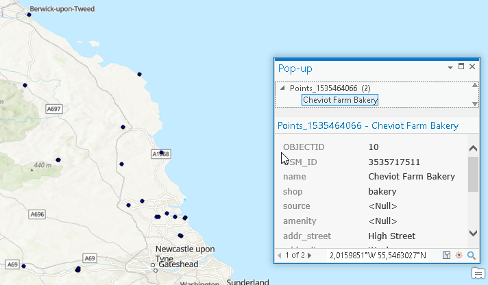
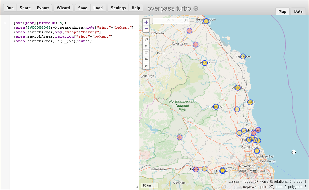
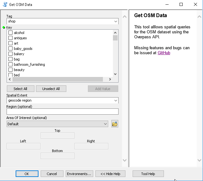
OpenStreetMapを使用する方法は複数あります。最も一般的に使われているのは、OSMデータセットをベースマップとして利用する方法かもしれません。他にはすでにArcGIS Editor for OSM<\/A>を使っている人もいます。しかし、ArcGIS内から直接OSMにクエリを送るソリューションは見つかりませんでした。答えるべき質問は「Northumberlandのパン屋はどこにあるか?」でした。Overpass APIはクエリを定義し、地図上で結果を得るための優れたクエリツールを提供しています。私はArcGISで同様だが使いやすいツールが欲しかったのでOSMQuery<\/A>を作成しました。OSMQueryは無料で使用できます。<\/P>
<\/P>
(上記の画像は1日後にはすでに古くなっています。この投稿の最後をご覧ください!)<\/P>
クエリはOverpass APIに送信され、JSONオブジェクトで応答されます。JSONオブジェクトにはノード、ウェイ、リレーションなどの要素が含まれています。<\/P>
{ "version": 0.6, "generator": "Overpass API 0.7.55.4 3079d8ea", "osm3s": { "timestamp_osm_base": "2018-08-29T08:10:02Z", "copyright": "このドキュメントに含まれるデータはwww.openstreetmap.orgから取得されています。このデータはODbLライセンスで提供されています。" }, "elements": [{ "type": "node", "id": 2496059820, "lat": 51.0703208, "lon": 4.9863343},{ "type": "node", "id": 2496059823, "lat": 51.0703401, "lon": 4.9865653},...{ "type": "node", "id": 2496059818, "lat": 51.0702779, "lon": 4.9863413},{ "type": "way", "id": 242035363, "nodes": [ 2496059820, 2496059823,... 2496059818, 2496059820 ], "tags": { "OnroerendErfgoed:criteria": "M", "addr:city": "Veerle", "amenity": "place_of_worship", "building": "house", "denomination": "roman_catholic", "description": "Parochiekerk", "heritage": "4", "heritage:operator": "OnroerendErfgoed", "heritage:website": "https:\/\/inventaris.onroerenderfgoed.be\/dibe\/relict\/41142<\/A>", "image": "https://commons.wikimedia.org/wiki/File:Veerle_-_Onze-Lieve-Vrouw-in-de-Wijngaardkerk.jpg", "name": "Onze-Lieve-Vrouw-in-de-Wijngaardkerk", "ref:OnroerendErfgoed": "41142", "religion": "christian", "source": "AGIV", "wikimedia_commons": "Category:OLV in de Wijngaardkerk (Veerle)" }} ]}>> >> >> >> >> >> >> >> >> >> >> >> >> >> >> >> >>
サインインしたメンバーは投稿、更新のフォローなどができます。初めてですか?無料アカウントを登録してください。
Find useful guides, FAQs, and documents to help you navigate and make the most of Esri Community.