In ArcGIS Pro, it is possible to add alternate symbols for a set of unique value-derived symbols to allow for different symbology for a given class at different scale ranges. I've attached a screenshot of what I mean.
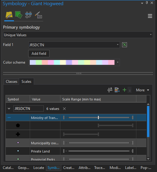
This works great in ArcGIS Pro...I zoom in and out, and the symbol changes completely when going through the scale threshold.
However, when I export the map into a Mobile Map Package, the scale-changing behavior does not take effect. Instead, the point only shows when in the scale range for the first symbol in the list (i.e. the scale range starting at 0.0), and once I've zoomed through the threshold, the point disappears.
In other words, it appears that ArcGIS Runtime (tested against 100.7) does not support alternate symbols for scale ranges in this manner.
Questions are...
- Is this expected to work, or is this a bug/missing feature?
- If this is not expected to work, is this on the ArcGIS Runtime roadmap, and for which release?


