Hi 🙂
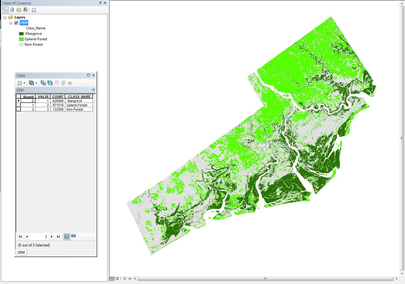
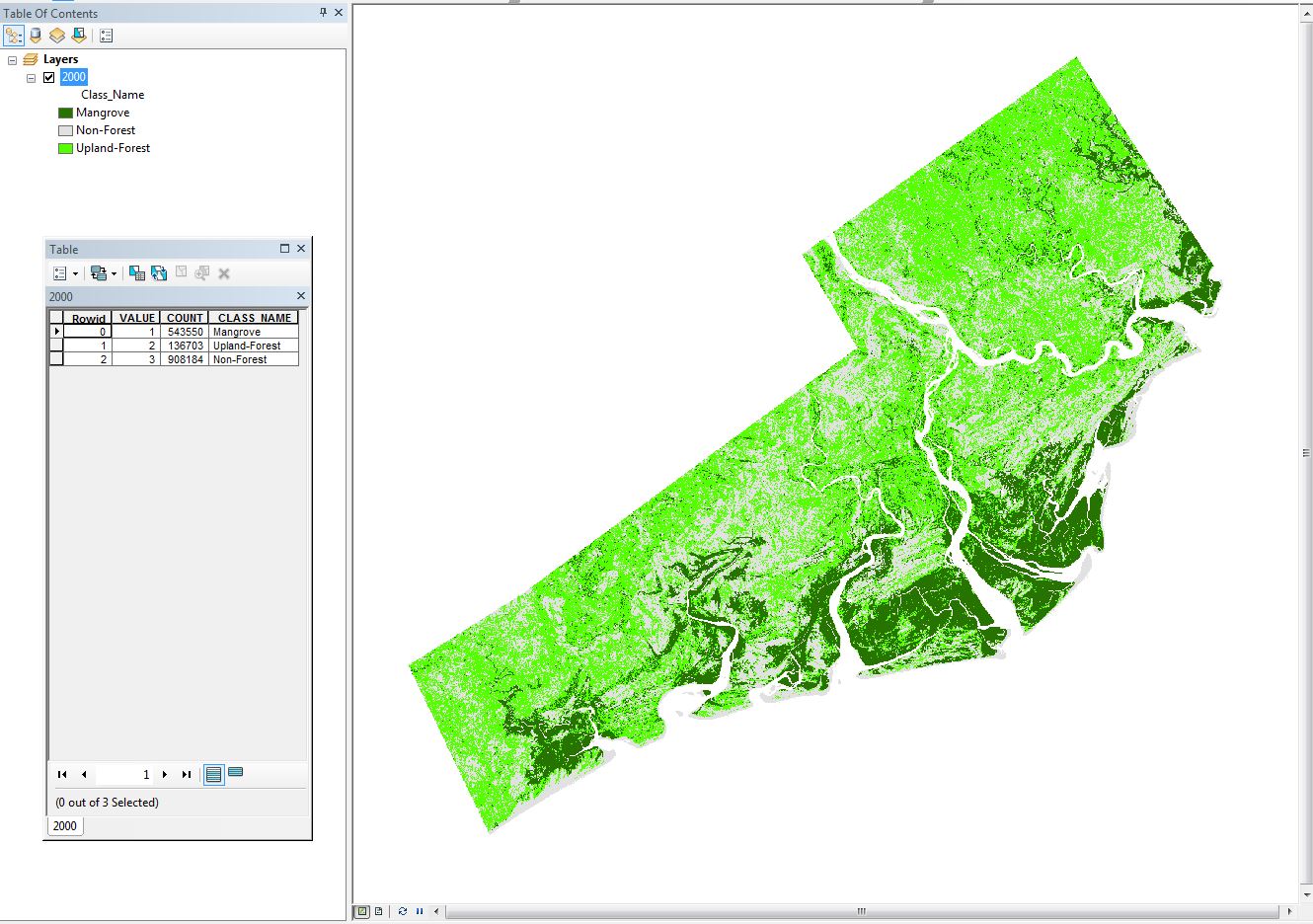
I have two classified images of different years. I am interested in mapping the gain and lost of my study area. So change detection tool is the tool, right? More specific to say, I would like to ask ArcGIS (10.2) to show me those pixels which have been changed. I have three classes of Mangrove Forest (with value of 1), Upland-forest (value=2) and non-forest (value=3). I would like to see the changes in just of my classes.
Year 1994
Year 2000
I appreciate any help of yours.
Cheers,
Sadra

