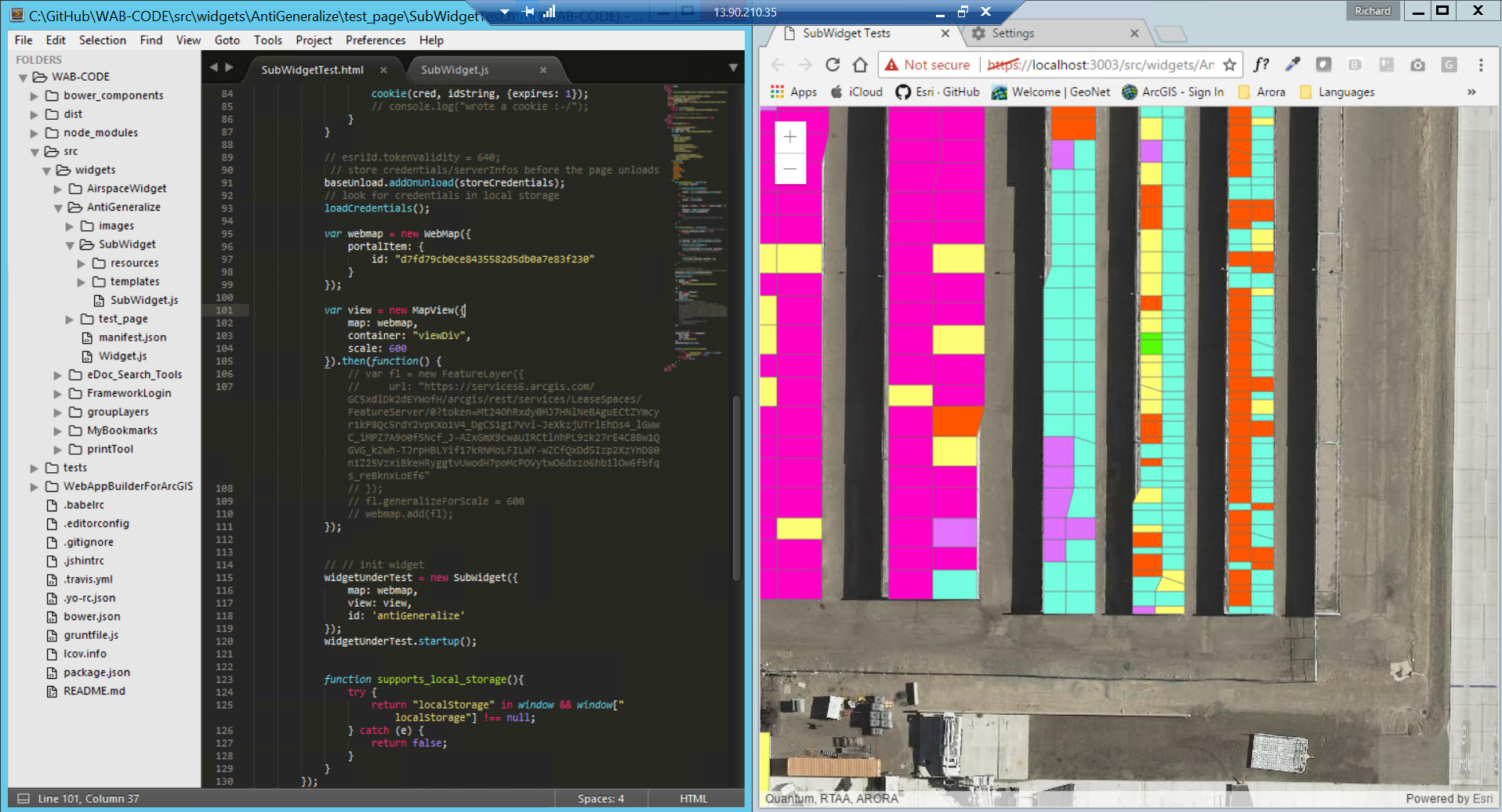
It appears that the features rendered in the WebView and MapView have a higher max allowable offset than the same features rendered in a web map in AGOL. The 90 degree angles look good in the 2d api, but when they are drawn in 3d, they turn into non-90 degree angles.
My guess is that the 3D api enforces a higher max-allowable offset which is making the data quality poor. I am going to try to manually adjust this setting on each layer in the scene, but I am wondering whether this is the correct approach.
Has anyone else run into this issue with shapes being modified in 3d at large scale?
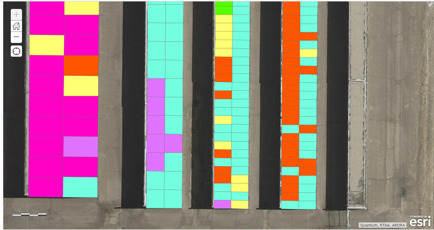
The first image shows the polygons in a web map in AGOL
The second image show the same web map rendered in an Map View on my test connect web server. As you can tell, there is a major issue happening somewhere