I am working with polygons whose centroids I found using Feature to Point to make sure the centroids fall INSIDE the polygon. However, when I transfer the coordinates of the very same centroids into a csv file which has the bulk of my data which I need to map, some (not all) of the mapped centroids do not align with the actual polygon centroids. I've checked and rechecked (and redone the entire process multiple times) to make sure the coordinate systems are the same. They are both GCS WGS 1984.
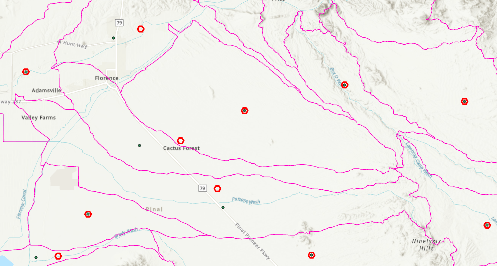
For context, the red hollow hexagons and the black dots should align. In some polygons this is the case but in others they're not aligned, and it even falls outside the polygon causing double data for one polygon and none for the adjacent. (If this makes any difference, I'm trying to associate timeseries data to each polygon. Which is why I created a centroid of the polygon, in reality the exact location does not matter, just as long as it falls INSIDE the polygon which is currently not the case with my failed attempts).
What am I doing wrong here?! And what should I do to correct it?
I've tried XY Table to Point from the csv table in my gdb as well as straight Create points from table -->XY Table to Point from the standalone csv table. Both methods yield the same (partially incorrect) results.
I've also tried reprojecting using the Project tool to no avail. Creating a shapefile and using that to map the data didn't work either.




