Hi Team,
I am working on Canada FSA Digital Boundary Files which are available on gov website (https://www12.statcan.gc.ca/census-recensement/2021/geo/sip-pis/boundary-limites/index2021-eng.cfm?year=21).
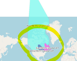
I have download this shape files and it is in EPSG:3347 NAD83 / Statistics Canada Lambert coordinate system, now my requirement is to transform this into EPSG:4326 but after changing the projection polygons shape is changed and on arcgis online it is displaying very bad. Can you please help me , how to change the cordinate system so its view should be correct