Hi there
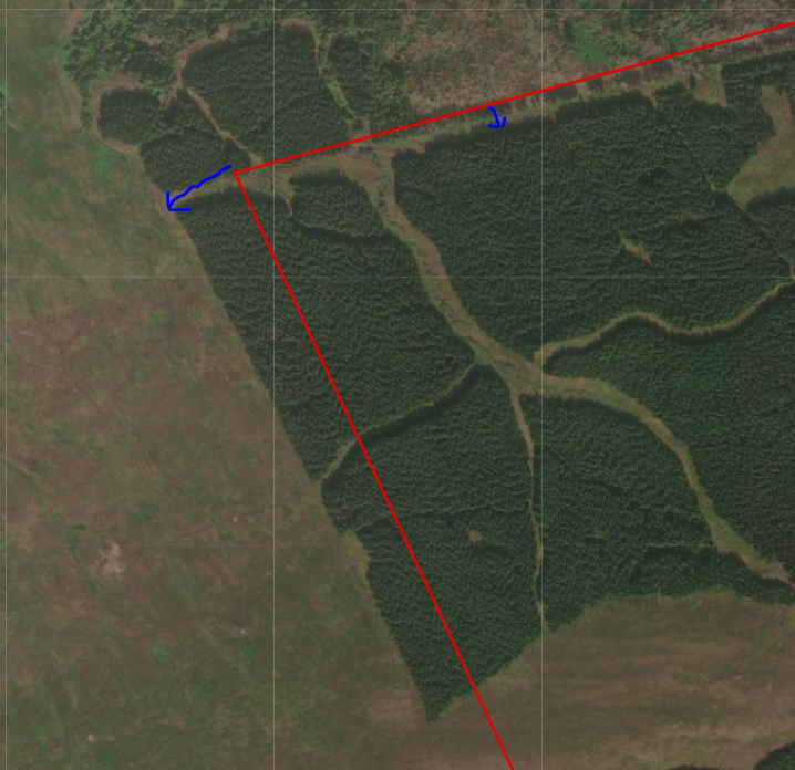
I have noticed that when I post data in the BNG projection online, they are offset slightly.
I solved this by either using a BNG basemap from AGOL layers or projecting the data to WGS84 or Web Mercator before I post it.
However, I thought that the data was meant to project itself on-the-fly when online?
Is there a way to fix this or should I keep projecting all my data before I post it online?
In the case of the latter, what projections does everyone suggest I use for UK Data (England, Wales and Scotland)
Here is a snip of one of my boundary line offsets. You can see the line is meant to follow the tree line here. Before posting online, it looks perfect in ArcPro.