Good evening,
I'm trying to recreate the following map, which is a 30 year climatology of tornadoes in the U.S.:
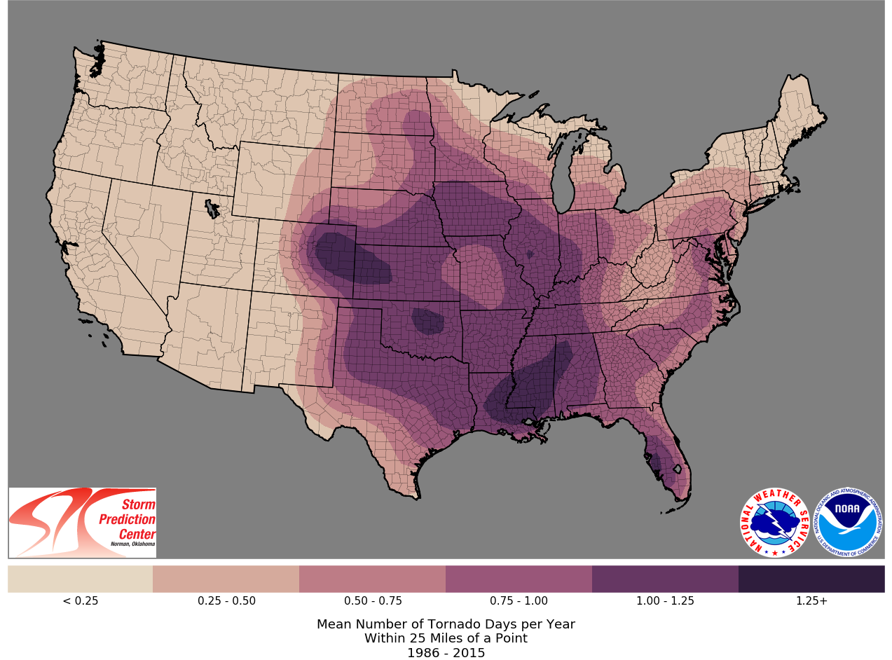
I noticed that the map illustrates the mean number of tornado days per year within 25 miles of a point. I took a few college courses in ArcGIS--many moons ago--so I know the knobology of ArcGIS Pro. My workflow is rusty, though, and I'm having difficulty performing the spatial analysis. The vector data I'm working with is a series of polylines. I've attached a few images of my data below:
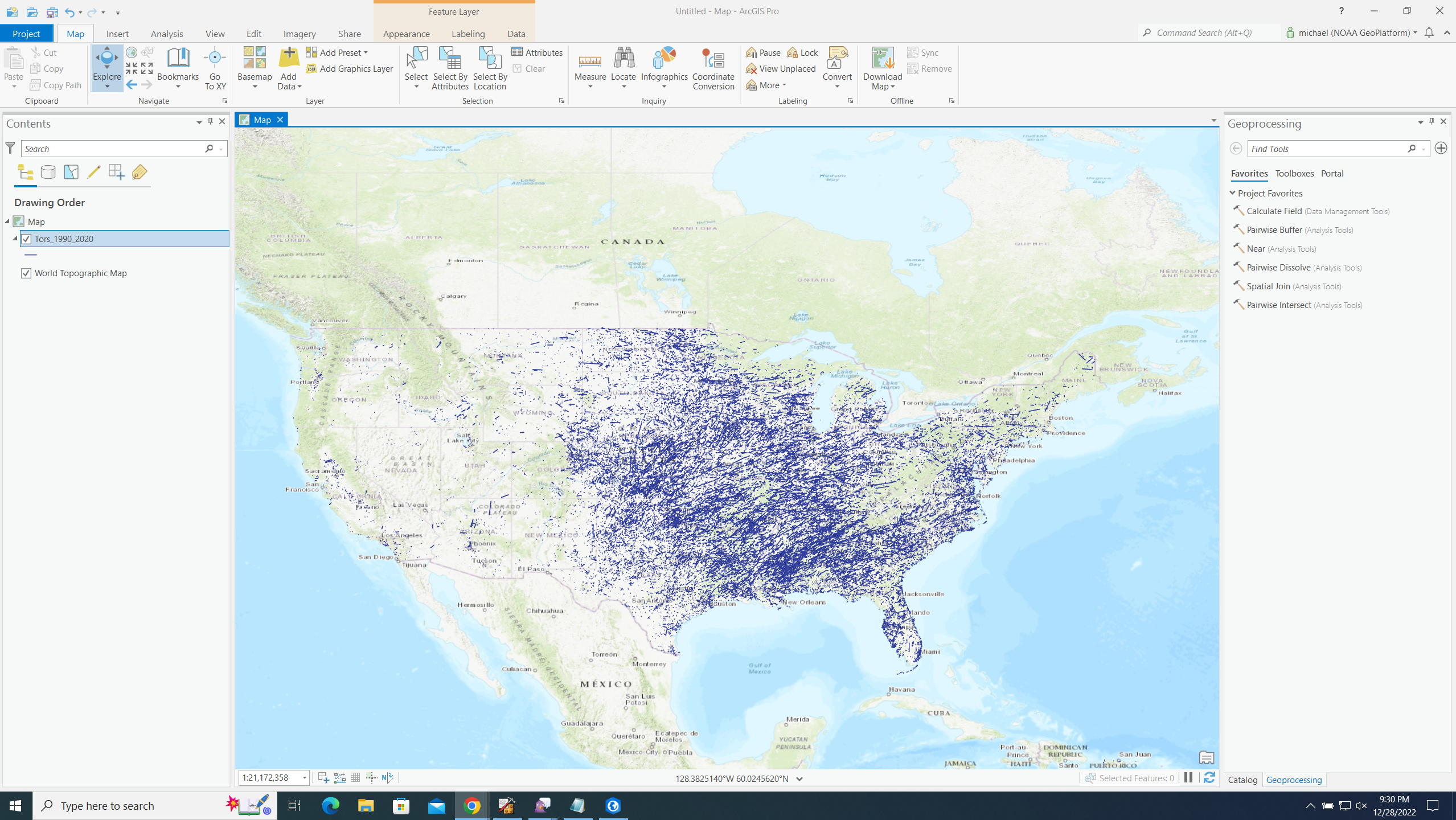
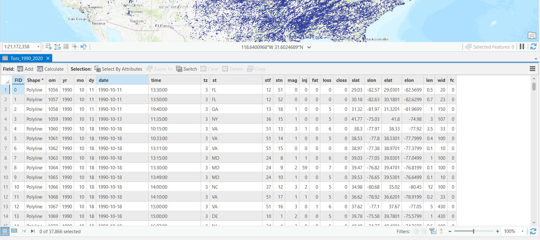
Can anybody give me any hints as to which spatial tools I'm going to need to use to recreate the tornado climatology?
Thanks!

