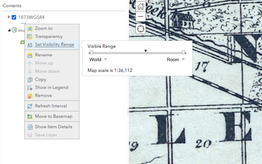
I've georeferenced an old map and published to AGOL as a Tile. It's GCS is WGS1984, and it appears fine in the web map. I set the visibility range from World - Room in the web map (classic) and saved. In the swipe map the layer doesn't show after what appears to be about the Streets scale. In other words, the scale set in the web map isn't honored in the swipe map. I want the image to remain no matter how far the user zooms in in the swipe map. How can I achieve this?