ArcGIS Pro: How to set the DEFAULT coordinate system for Maps in a Project?
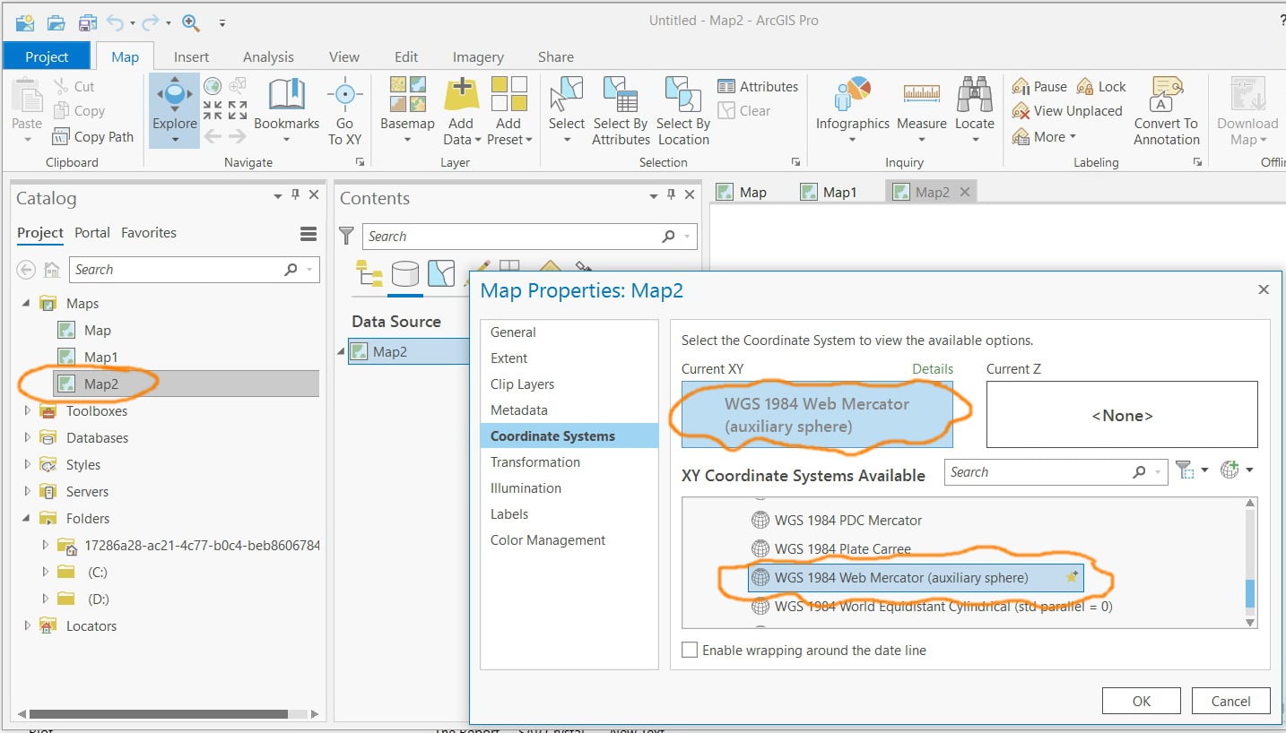
I observed that the default coordinate system for created maps is “WGS 1984 Web Mercator (auxiliary sphere)_1”.
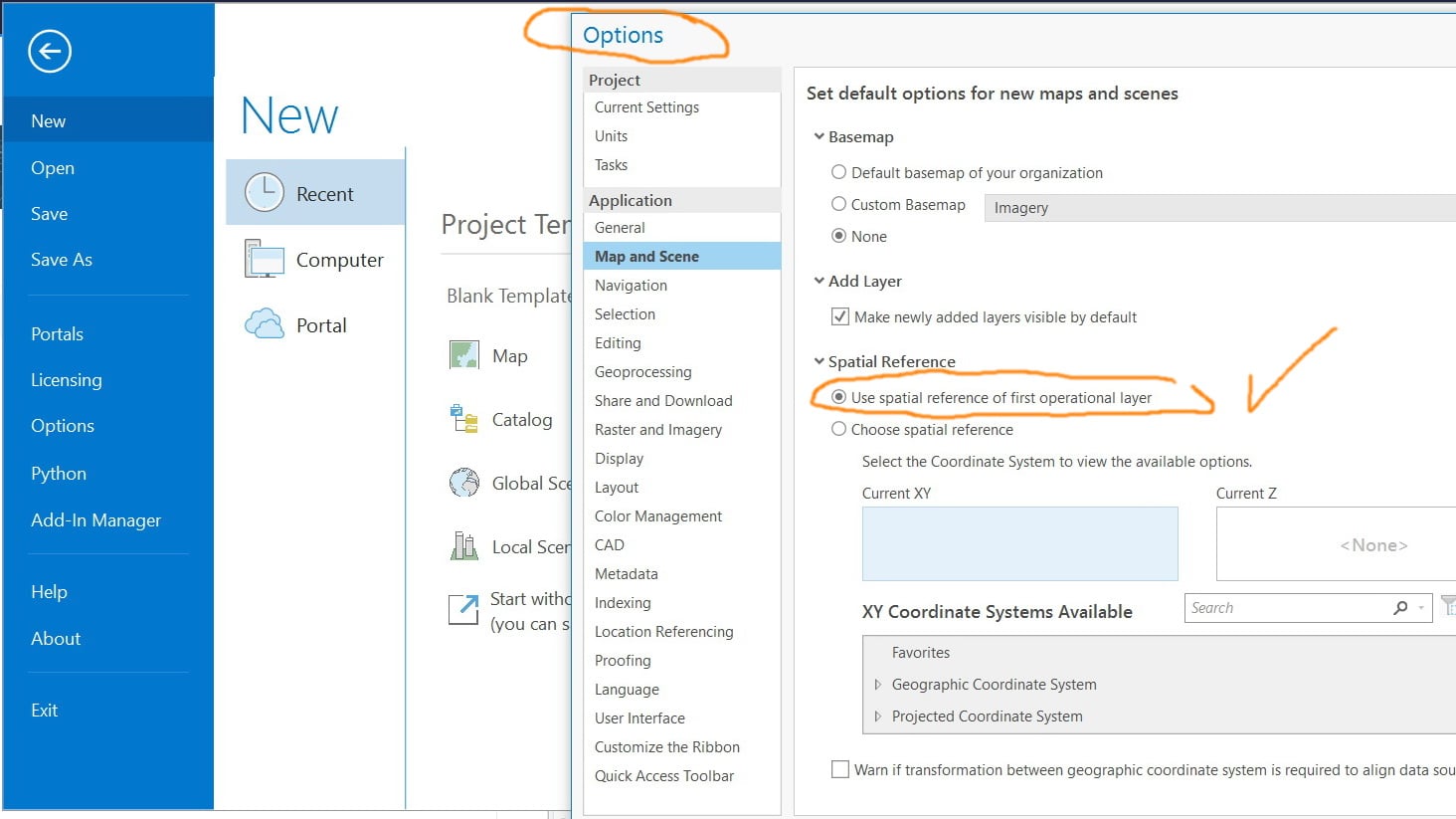
How this can be switched at the level of Pro for all created projects (aprx) and their maps?