ArcGIS Pro 3.0.2: Saving the georeferenced image ends up with black image,
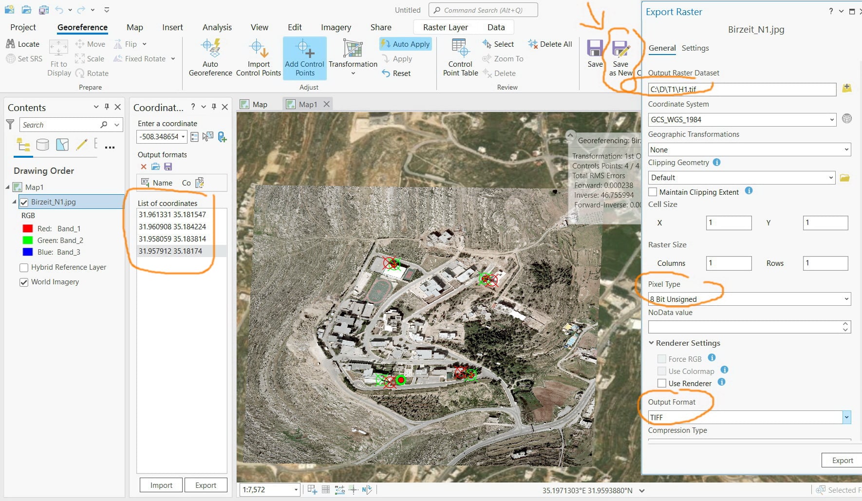
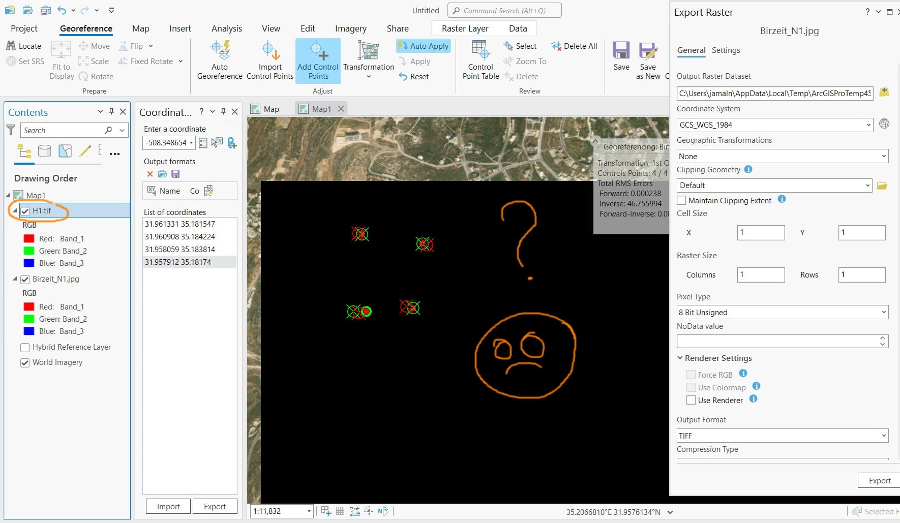
I couldn’t figure out why Saving the georeferenced image ends up with black image as per the screenshot below.
What could be the issue here?
Is this a bug?
The image is attached
I tried it in Pro 3.1.1 and found out that it works fine with no issues. Both the cell size (in x and y) and the number of columns and rows are populated automatically.
It appears that this is a bug in Pro 3.0.2. I hope that Esri developer can comment on this
Huh. These are my default values, I didn't change anything:
Raster and cell size seem to be dependent on another. Try inputting the column and row numbers of the original image, hopefully it will calculate the corresponding cell size.
But I never touched the cell size nor the number of columns\rows of the georeferenced image. As I know, these are handled automatically by the ArcGIS. The original cell size and number of columns and rows of the image are as per the screenshot below
Why the ArcGIS change the number of columns\rows of the georeferenced image but didn’t change the cell size (X and Y)?
Your cell size and raster size parameters are wrong. If I use the default values, it works. If I use 1, I get the black image.
Les membres connectés peuvent publier, suivre les mises à jour, et plus encore. Nouveau ici ? Inscrivez-vous gratuitement.
Find useful guides, FAQs, and documents to help you navigate and make the most of Esri Community.