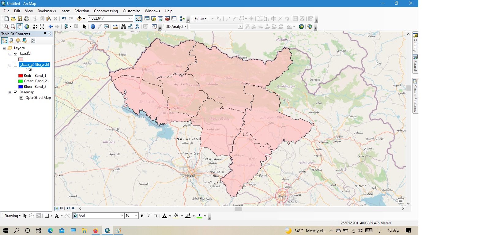
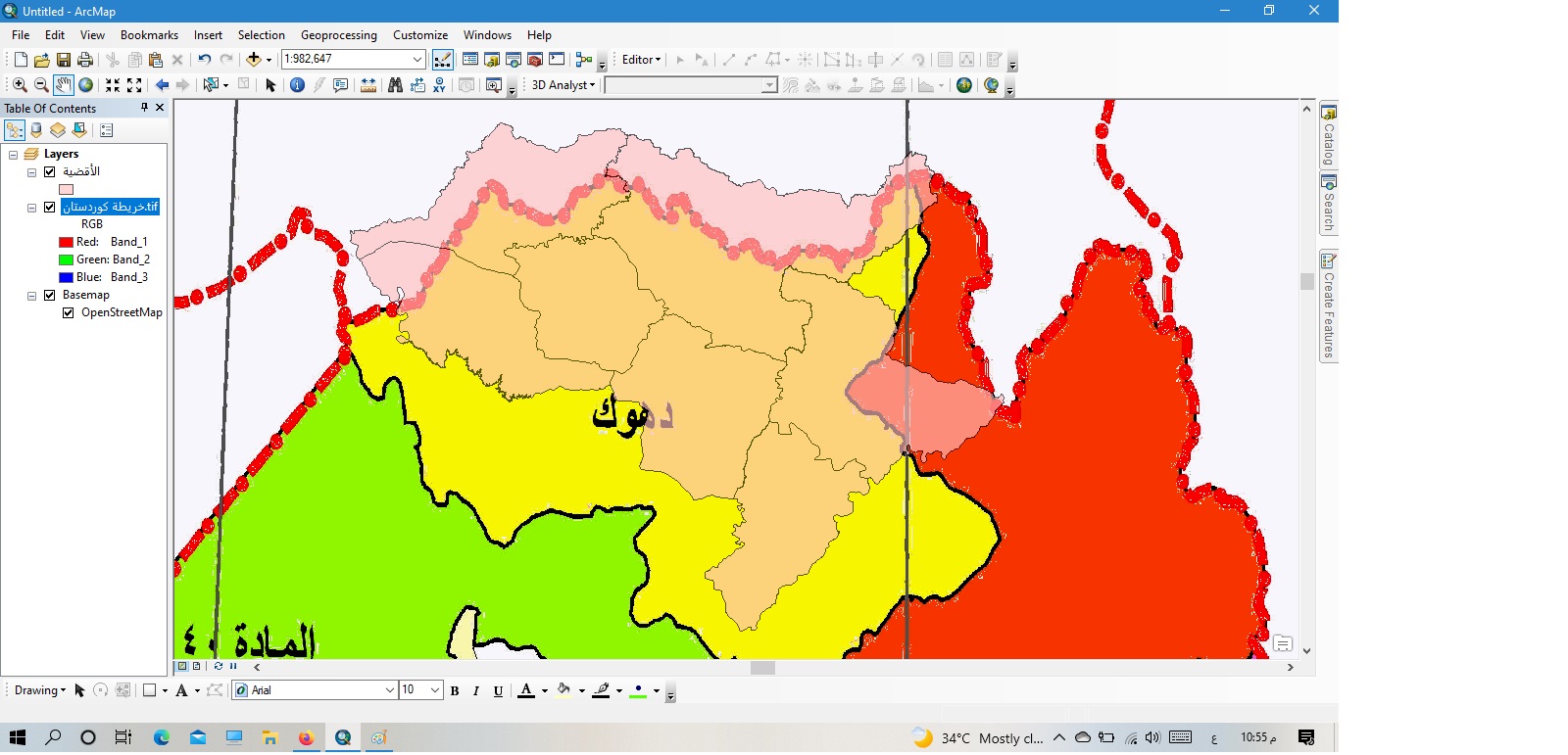
Salutations, le sujet s'interroge sur le sujet de la carte et la justesse du dessin. J'ai dessiné une carte il y a quelques jours et comme cela était montré dans la première figure, et basé sur le service des cartes de base du programme, et lorsque je l'ai comparée à une vieille carte du nord de l'Irak datant de 1986, j'ai remarqué qu'il y a un décalage dans la localisation et l'emplacement des phénomènes dessinés. Faut-il modifier les cartes annuellement parce que la terre sous nos pieds se déplace chaque année de quelques millimètres à plusieurs centimètres, ou ce problème a-t-il un rapport avec le fait que seule l'ancienne carte aurait pu être dessinée avec un autre site de dessin ? Merci beaucoup si vous pouvez nous expliquer davantage cette idée. Merci.
Hi @kurdishbrwar ,Your new (pink) data aligns well with the basemap, so I think you can assume it is correct, while the old map is inaccurate.The old map is a raster image, so it may have been georeferenced from a paper map or image. It's possible that it wasn't georeferenced very cleanly, or was georeferenced against inaccurate reference information. If you need it to align it correctly, you could try to georeference it again yourself.
It may also not align properly because of coordinate system mismatches. Check to see if the new data, the old data, and the map itself are all in the same coordinate system. If they are not, a transformation might be required.You might find this article helpful if you need to work with transformations. It is written for ArcGIS Pro, so the steps will be different, but the theory will remain the same for ArcMap.
Hello, Greetings, Mrs. Heather Smith, your answer is more than wonderful, scientific and logical. I will do what you indicated in the response and I am happy for your response to the post. Greetings again, your colleague Sabah.
Les membres connectés peuvent publier, suivre les mises à jour, et plus encore. Nouveau ici ? Inscrivez-vous gratuitement.
Find useful guides, FAQs, and documents to help you navigate and make the most of Esri Community.