I used a DEM to create 2 ft contours for my county. That process worked great, however I received a warning message telling me that some features had over one million vertices. Upon looking at the created contours, I can definitely see that each feature has a very large number of vertices. Additionally, it also captured tons of very small "islands" of high or low elevation. Example below:
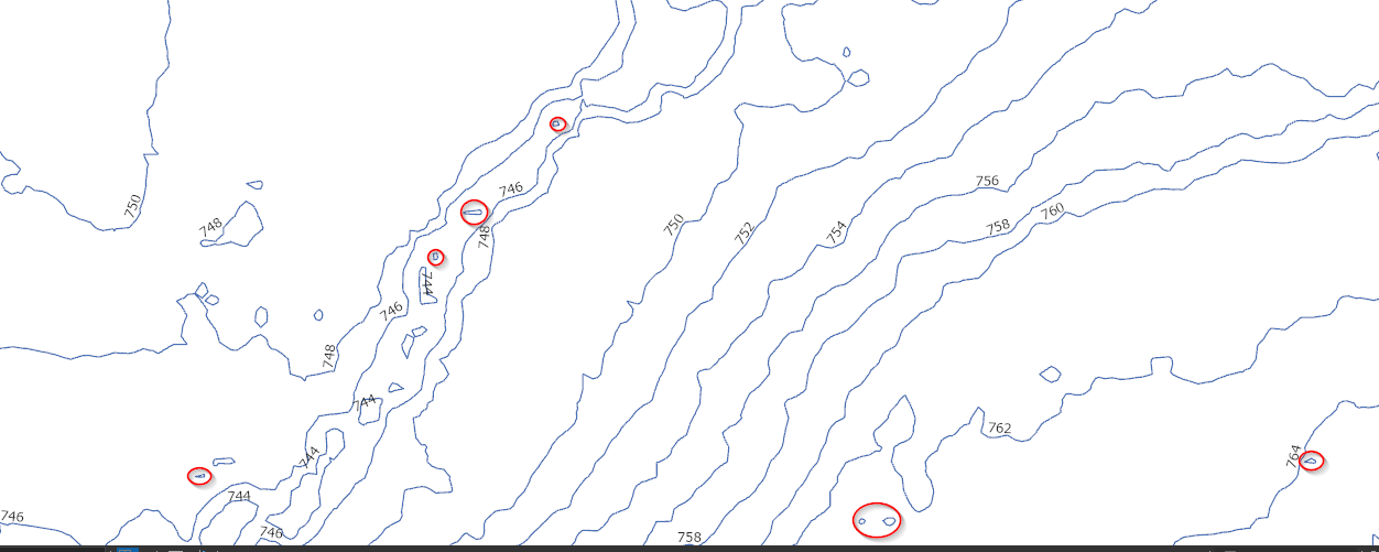
I circled a few examples of some of these tiny areas of elevation that are insignificant enough to be removed. Is there a good way to simplify the lines without giving up a ton of accuracy and to also remove small islands of elevation?






