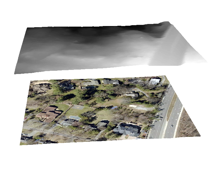
i am having trouble with something i've done a bunch of times. i am trying to drape an aerial on top of a raster. i've done the "obtain height from raster" for both the raster and the aerial in arcscene. the raster keeps hovering over the aerial (see below). any thoughts?
thanks. problem is that i need my layers to be 3d so i can create a webscene. that's why i used interpolate to shape using the dem. but as i said, everything drapes beautifully except for the image which sits below. i've done this a million times and it's not working this time.
I think you are double draping. Get the DEM in alone, do any vertical exaggeration you need, then add the other layers and do the assign base heights... assuming the rest of the layers are 2D and not 3D
ok, but when i then try to drape a polygon z road layer (derived from the DEM), it also hovers above the aerial (see below).
you only assign the base heights to the aerial, not the DEM... assuming that is a DEM
Les membres connectés peuvent publier, suivre les mises à jour, et plus encore. Nouveau ici ? Inscrivez-vous gratuitement.
Find useful guides, FAQs, and documents to help you navigate and make the most of Esri Community.