Hello !
I'm working with Pleiades panchromatic images in ArcMap. When I load the DIM file my image appears correctly in my project. But I would like to verify that the RPC's are being taken into account and I would like to use a DEM to orthorectify the image.
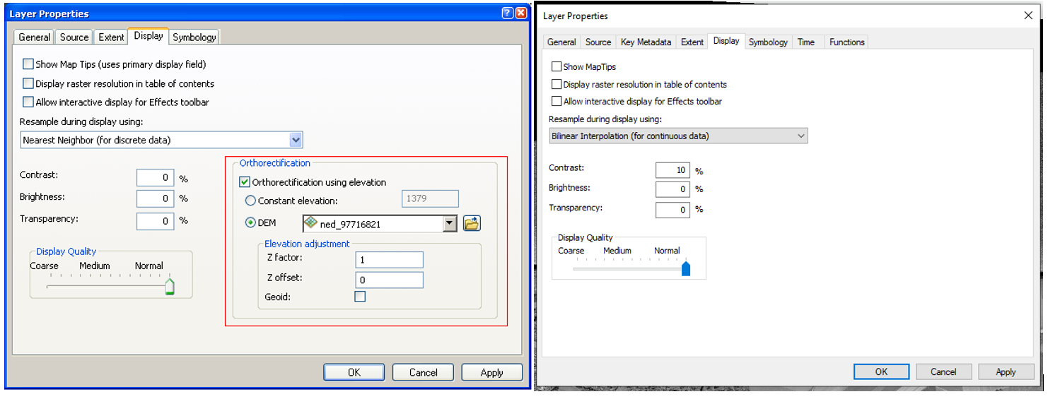
If the RPC file is taken into account correctly I should have an orthorectify option in the layer proprieties of my image (display tab). If there is no RPC file found then this option should be grey-out. But for me, the option doesn't even exist.
Any ideas ? Thanks in advance !