Hello,
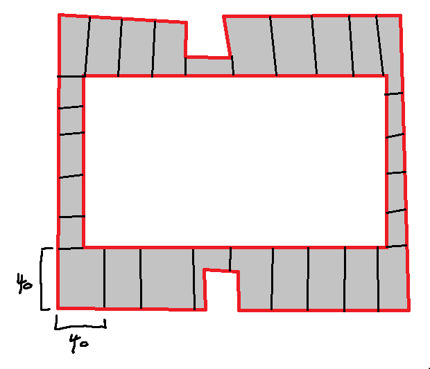
I have an irregular polygon. It looks something like the crude drawing to follow outlined in red. I want to break it into smaller polygons so that the polygon is roughly equal to a 40-by-40 foot square--or as near to it as possible. I have not been able to locate any resource that can automate this for me or somehow make my life easier. If anyone can point me in the right direction that would be appreciated.
Do you just want to split it where the parcel lines (assuming parcel lines) are?
The polygon-line that exists in the image are in red. I would like to split the polygon into smaller zones shown in black. I need those zones to be as close to a 40x40-foot square as possible all the way around the red-polygon.
Reason: I have a large data set of screenshots from an app and because of the unorthodox methods used--such as having to zoom into a more discreet view--the overview screenshot is not sufficient to georeference the data alone. So, I want to break the polygonal area into zones so that I can visually input the number of objects into a table and run further analysis on the overall data set. I have somewhere in the ballpark of 500 images and batch georeferencing wouldn't do the job either.
create a 40 x 40 foot square starting in one corner. Copy and paste it and then use the move command to move it 40 feet in one direction or another. Paste again and move 80 feet.etc..
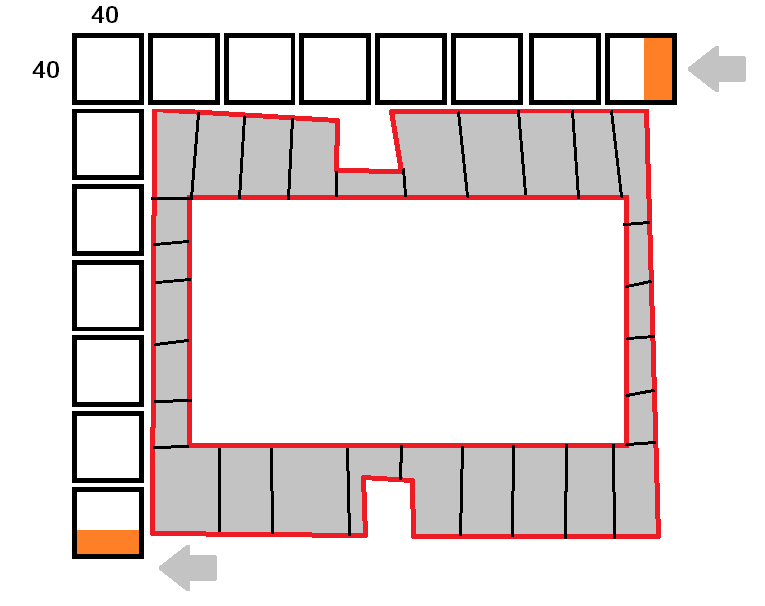
This was one method I had considered but there is a slight problem which I am afraid might objectively hurt the analysis and why I was hoping there was a tool of some sort to alleviate this issue. Let this crude drawing illustrate my concern and please let me know if you feel it's an unfounded one.
If I make a 40x40-foot polygon and use the move command as you suggest, then, I worry that the manual input will result in a larger deviance and open up the analysis for inaccuracy due to both this deviation and selection bias. I suppose that I could repeat this process for all corners and examine the statistical deviation to determine if the percentage is worthy of such criticism but that is by far more work than I think I have time to do.
This is part of my thesis paper so accuracy is paramount.
Suggestions? Do you think the move command is best? Thoughts on my concerns?
Thank you Robert!
Les membres connectés peuvent publier, suivre les mises à jour, et plus encore. Nouveau ici ? Inscrivez-vous gratuitement.
Find useful guides, FAQs, and documents to help you navigate and make the most of Esri Community.