Hello
I am experimenting with Trimble Catalyst and a Samsung S3 tablet with LTE. Sadly, I am not getting the full GNSS metadata for points collected using this service. My set up is below:
- Map is here
- FS is here - Spatial Reference: 4326. I created the GNSS metadata fields using the Python tbx here
- Maryland KeyNet VRS accessed through Trimble mobile Manager – this uses NAD83 2011
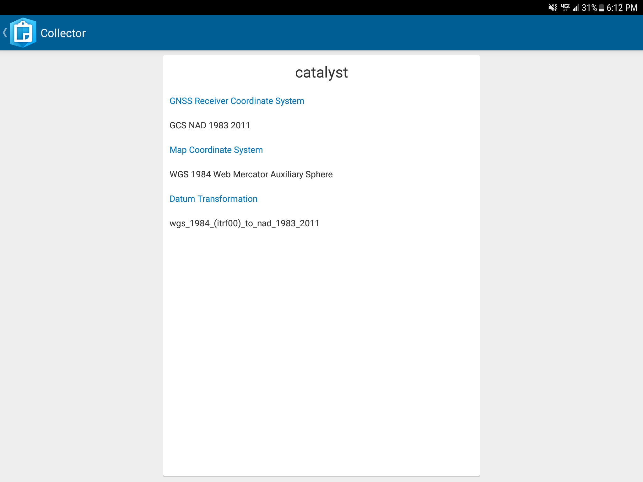
- Configured a location profile within Collector as shown in attached. Things to note about this:
- firstly I set the ‘map coordinate system’ value to GCS WGS 1984 – which is the same as my FS
- however, collector tells me “the map uses a different coordinate system than the location profile”
- so I have to change it to WGS 1984 Web Mercator Aux Sphere
My results are below. I'm not getting anything for the blank metadata fields. Any help on the correct configuration would be appreciated.
Thanks
Receiver Name | Catalyst |
Horizontal Accuracy (m) | |
Vertical Accuracy (m) | |
Latitude | 40.05 |
Longitude | -75.48 |
Standard Deviation (m) | 0.02 |
PDOP | |
HDOP | |
VDOP | |
Fix Type | |
Correction Age | |
Station ID | |
Number of Satellites | |
Fix Time | 2/22/2018, 6:09 PM |
Average Horizontal Accuracy (m) | 0.55 |
Average Vertical Accuracy (m) | 0.67 |
Averaged Positions | 5 |
Altitude | 132.69 |