Hello,
I couldn't find an answer to this in previous discussions so hopefully I'm asking a new question.
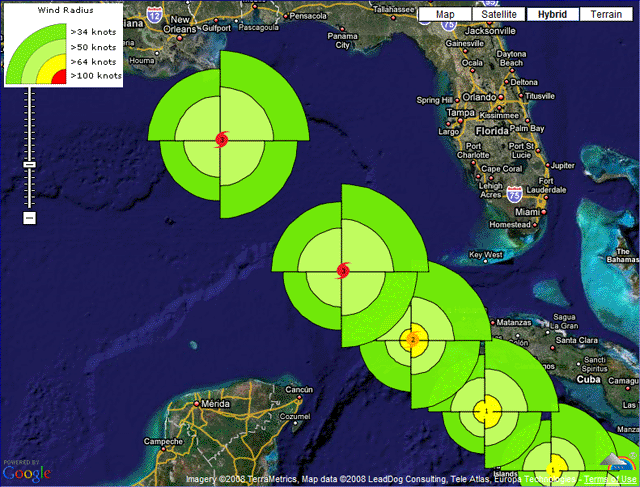
I am using ArcMap 10.2.2 and I have "extended best track" data for tropical cyclones which has latitude and longitude locations of storms at 6 hour intervals as well as estimated wind radii for the NE, SE, SW, and NW quadrants at those locations. For instance, at lat x long y, this data might have estimated radius for a 64 kt wind of 100 nautical miles in the NE quadrant, 75 nm to the SE, etc.
So basically, I want to buffer these point locations with quadrant specific radii based on the attribute for that quadrant. Is this possible to do? I'm not well versed in coding but I would be willing to try to figure it out if it is possible and can be automated either with python or model builder to do for multiple storms. Any suggestions would be much appreciated.
Thanks,
Pat