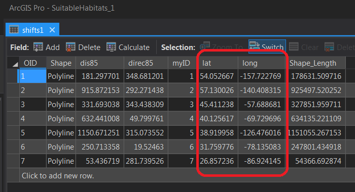
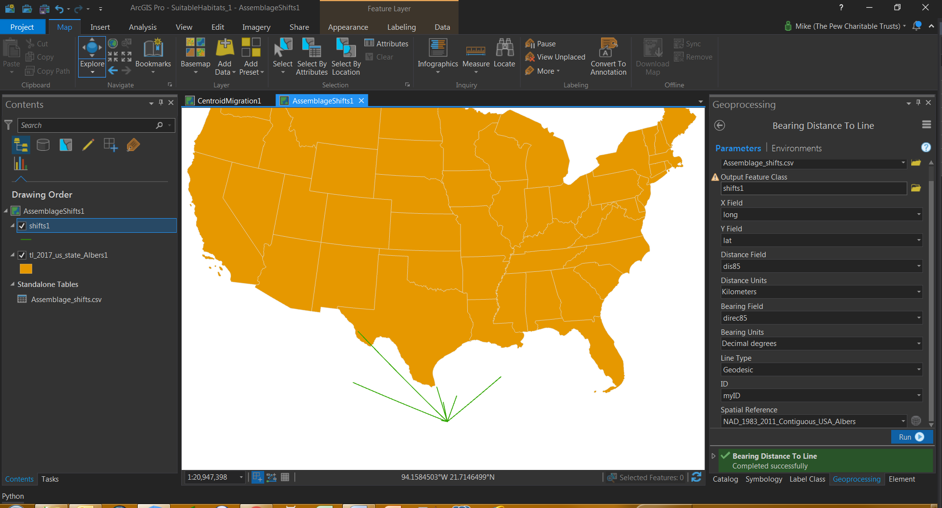
I'm using the Bearing Distance to Line tool in ArcPro 2.1 with a small dataset of 7 observations. The Lat/Long data is from 7 different points around marine areas surrounding the U.S. but despite the data showing different Lat/Long locations, the output has all lines originating from a single point. Also, the lines' origin is not even one of the Lat/Long points in the table. Anyone know what's wrong here?