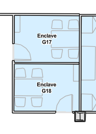
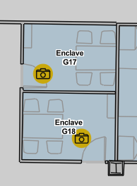
When 360 photos (via Oriented Imagery dataset) are added to the Indoors Viewer app (browser), a button to "Show 360 Photo Locations" becomes available. By default, the symbols for these photo points are hidden from the map until this button is clicked.
When the button is clicked, the map is greyed out and the 360 photo point symbols appear. However, these symbols are greyed out along with the rest of the map. I imagine the intention might've been to grey out the map and have the photo points remain at their normal brightness so that the user can find them easier, but it doesn't appear to be working correctly if so.
It would be great if the grey mask applied only to the map beneath the 360 photo points, so that the points could stick out visually. (As a sort-of workaround in the meantime, I've applied an animation to the symbols to make them pulse and have them stick out more)