I have 3D cube of atmospheric data (wind speed, temperate, etc.). We typically display this data to the user as horizontal 'slices' at each altitude from the dataset. This works great for RasterLayers in a 2D MapView. I was curious if I could display a vertical slice of this data in a scene view? We are already generating these vertical slices of the data, but we are displaying it in a plot, not on the map. It would be helpful for visualization of the environment if I could display this data directly in my map alongside other data.
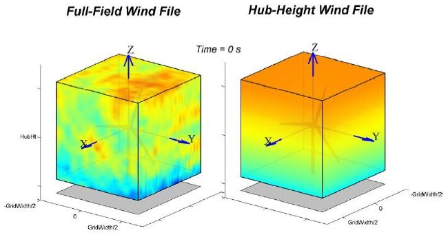
I've included a picture for reference. The idea would be to display one of the side faces of the cube, rather than just the top face.
Any idea if this is possible?

