Hello,
I'm looking for suggestions to clean up some polygons I've generated from rasters. I want to explain what I've done up to this point first to give some background information:
1. Generated rasters from contour data to show 'low lying areas'. I have ~350 rasters, because for the scope of this project, I needed to generate a unique raster for each relevant polygon (each polygon has a different definition of/parameters for a low-lying area)
2. Clipped each of the resulting rasters to its appropriate polygon, using the polygon's geometry as the clipping extent:
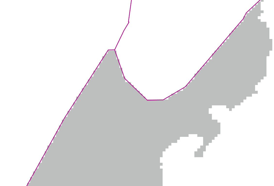
3. Converted each of the rasters to polygons:
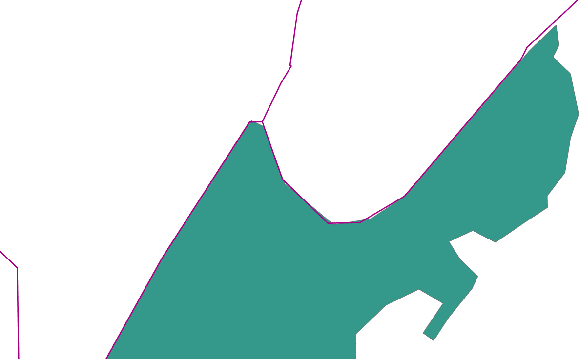
As expected, the perimeter of the resulting polygon does not perfectly match the original:
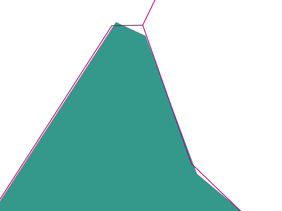
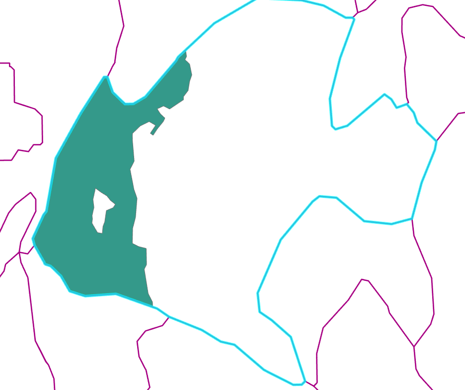
How can I clean up the polygons I've created so they match the boundaries of the original polygons? If there were only a handful of them, I'd just do it manually using trace tools, but with 350+ polygons, this isn't feasible. I also cannot take the original polygon geometry and apply it to the generated polygons, because that'll defeat the purpose of what I've generated (green polygon is the low-lying area generated from the selected polygon):
I've tried using the Align Features tool, but it's not giving me the results I was hoping for.
I've also tried the Overlay Layers tool, and when combined with spatial & table joins, I am able to delete the bits of my polygons that overlap into the wrong original polygons. So that gains me a bit of progress, but I still end up with small gaps
Each of the generated polygons has a field ("POLY_ID") that matches the original polygon. I have access to almost all the Esri toolboxes.
Any suggestions would be very appreciated




