Buckle up, buttercup. This is a ride. (And, yes, I have looked at the Address Data Management Solution. Still doesn't have the one key component I need.)
I spent 2 weeks figuring out Survey123 connect, then found out it doesn't work the way I want and then discovered the Survey Widget and thought I could use it to do what I want it to do.
The "survey" is actually a form to apply for a new address. Currently the user fills out this application wherein they have to measure and list intersections. Sometimes the measurements are wrong, sometimes we get hand-drawn maps, etc. I figured if we have a single form with a map right in the form, they would be more apt to use it. And we can have them place the driveway directly where it is going to be without having to measure.
My biggest issue is with the map and getting it to zoom to somewhere near where the address is going to be. My thought was to have them zoom to the parcel. The map inside Survey123 doesn't allow you to search by a layer in the map, so I created a locator and had everything working the way I wanted. Only to find out that locators don't work with public surveys. No worries... I'll just build it in Experience Builder where I can use a layer as the source for the search.
So, here's the thing, I can't figure out how to make the Survey "look" at the map, and I can't get the map in the survey to turn off, even though I have it marked as hidden. I can get the data to pull from the map to the survey, but not from the survey to the map. When I test it and put in my information, then go click on the map they show up as two different records.

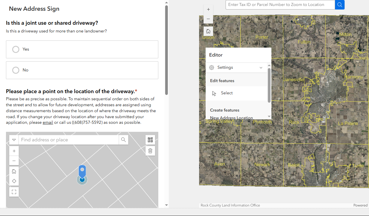
I did connect the survey and the map. It looks like this is the way to do it?
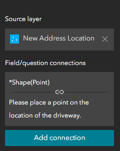
I tried adding the name and address fields to the connection to see if it would populate the survey, thinking that maybe if they put the point first, I would be able to finish the survey after they did, but it did not populate the existing form, although it did create a feature with the information that I supplied in it.
They do supply the parcel ID earlier in the survey and I had thought it would be nice for the map to zoom to the parcel with that information, but it is my understanding that I would need to create CSV with the x, y of the parcel ids to do that. Since there is a good chance these are new parcels I want to make sure the CSV list is updated nightly. Which means another script to run something at night and one more piece where things could go wrong.
Any ideas? Am I asking it to do something it doesn't do? Why can't I use my locators? (That last one is rhetorical.)
I have attached my XLSForm, and the here is the app I'm working on. (Yes. It's looks bad. I'm working on functionality first. LOL)
Please help. Or send beer.



