I am trying to write an attribute rule that compares a parcel's calculated area to the stated (deeded area) and if it is off by more than 10% of the total acreage to flag an attribute field for it. This rule does that:
//If the absolute value of error acres is greater than 10% of the stated acres, then report mismatch. Otherwise, report that it is acceptable.
var QAQC_Eval = iif(abs($feature.ERROR_ACRES) > ($feature.StatedArea * 0.10), "Acreage mismatch. Deeded acres and calculated acres do not fall within OCGIS tolerance.", "Acreage ok. Deeded acres and calculated acres fall within OCGIS tolerance.")
return QAQC_Eval;
The problem I am having is that there are sometimes exceptions where I need to be able to manually clear the flag and mark it as an exception (like in cases where I have looked at the issue but can't correct it due to insufficient information or some other problem).
I would have thought that if I had checked the "Editable" box in the attribute rule configuration, that this would allow me to manually change this value if required. Unfortunately, that doesn't seem to be the case because when I manually change that field, I get an error message saying "Edit Operation failed - no edits producing database changes were found." Here is the current rule configuration panel:
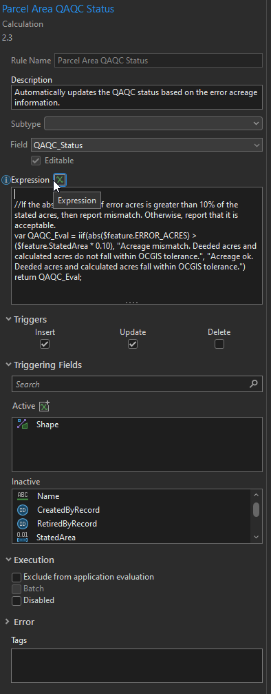
Ideally, this rule will only fire off if the geometry is changed, which is why I only have the "Shape" field set to active. Would really appreciate some help with this as this could really improve the QAQC process for our parcel data!

