Dear esri community,
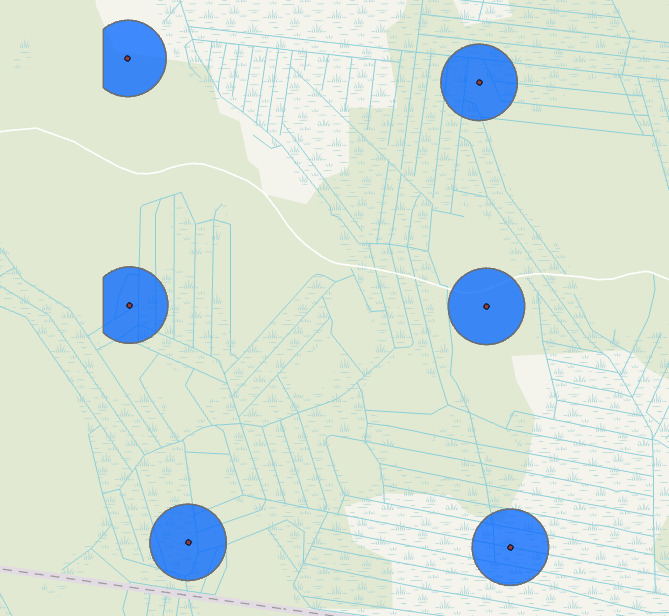
I'm doing a simple buffer operation around point features (Point ZM shapefile) but get these weird looking buffers for two of the points. Seems like those polygons are cut by a mysterious line. What might cause this issue? I checked Environments settings and tried with different (big enough) processing extents. Thank you in advance!
Extent (Environment setting)—ArcGIS Pro | Documentation
set your extent in the Buffer (Analysis) tool's Environments parameter to the extent of the map or preferably, manually and rerun the buffer
Doesn't help...
toggle off the layer underneath the buffer
is the buffer still the same?
Les membres connectés peuvent publier, suivre les mises à jour, et plus encore. Nouveau ici ? Inscrivez-vous gratuitement.
Find useful guides, FAQs, and documents to help you navigate and make the most of Esri Community.