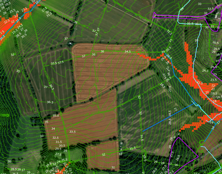
I have added lidar data from Defra survey data services to GIS file but it doesn't line up with the basemap - see image field shapes show it's out by a considerable amount. What's the fix?
Have also added SciMaps for connectivity and erosion, these also seem to be misaligned with the basemap.
Thanks


