Good morning,
I am trying to produce a map for a tree survey in which I need to display the tree canopy with directional measurements.
I have looked at the proportionate sizing and it doesn't look to be the correct function. The image below shows what I am trying to achieve. The symbology needs to display a central point, along with 4 measurements from this central point.
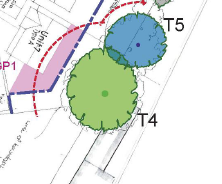
Any ideas on how to achieve this would be very welcome.


