The esri_label_generate command is great, however it lacks a ROTATION parameter as input.
In the CAD world, rotation parameters are imperative to objects, especially text objects, as the labels often needs to align with the associated data.
For example, I have a gas point dataset that has the text information as attributes.
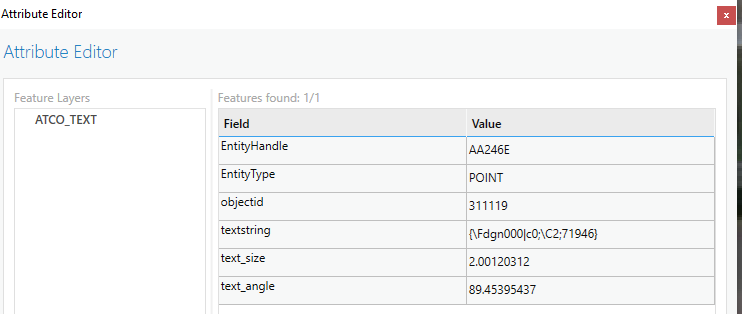
The text_angle is a default parameter that is maintained with text objects exported out of AutoCAD, along with size and text contents.
Right now, my current work around is:
Import point feature layer to AutoCAD using the A4A plugin
Select the point feature layer
For each point in the feature layer
     a. Grab the entity name & x/y coordinates
     b. esri_attributes_get(entity name) returns: textString, textSize, textAngle
     c. ACAD Command: (_MTEXT xCoord, yCoord, textSize, textAngle, textString)
This works, but grabbing each objects information and inserting a MTEXT object at that point one at a time is very time consuming.
Are there any plans for future versions to include the rotation as a parameter?


