I started creating custom elevation tile packages (tpks's) about a year ago in hopes hopes packaging up my 3D layers for an offline mobile app featuring 3D bathymetry.
I'm able to create the lower-res custom elevation basemap tpkx and hi-res seafloor elevation tpkx layers with no issues. One issue that has greatly impeeded the project's progress is this ongoing issue the tpkx's functioning as expected for a day or two, then start exhibiting anomalies, like tiles becoming disconnected, large areas in the models disappear/reappear, the hi-res layer doesn't render in hi-res, and blocky extusions shoot in and out of the 3D model as I pan in zoom over the afficted areas.
I opened a ticket with Esri Support last July (2023) which addresses this issue which happens in both ArcGIS Pro and ArcGIS Scene Viewer. Esri Support hasn't come up with logical explaination, solution or workaournd despite our weekly meeting to discuss the topic. I've become quite well versed with the myrid of requirements that must be met when created custom elevation tile packages as well as many combinations that can be used to build and share tile layers accross the ArcGIS suite of products. So the usual culprits have been checked and checked twice, including the correct tiling schemes being used for elevation layers, tiling schemes have to match basemap, LERC compression requirements, coordinates reference systems match across all related layers. And usually if there's something amiss with a tpkx's configuration, ArcGIS Online or Scene Viewer is quick to let you know about it.
Could this be 'Z fighting'? The 3D layers control doesn't give me the option to move the hi-res layer to #1 priority in the list.
Could this GPU settings? I have new computer with NVIDIA 3060 GPU, so should do the job, however the settings may not be configured correctly.
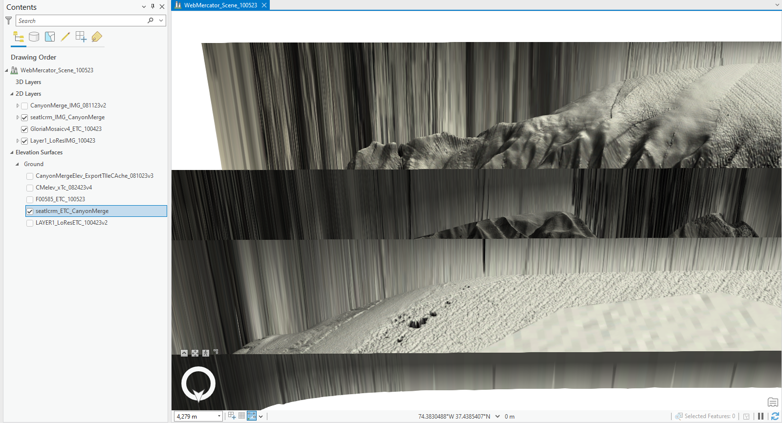
Here's a few examples the anomalies the render when zooming/panning around the 3D model.
At some zoom levels, the 3D model disappears completly.
Image 1a - 8035m above 3D terrain - No tiles in terrain model are visable (desite caching tiles a Level 20 in the scale)
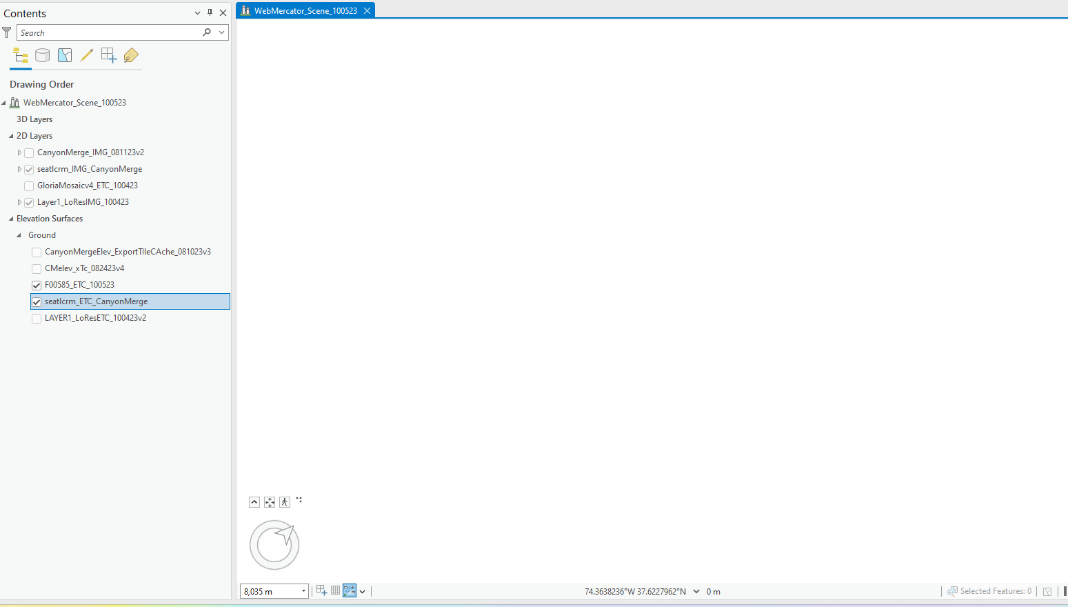
Image 1b - 6045m above terrain, half the tiles in the area in focus display with the upside-down V wall at cut off point.
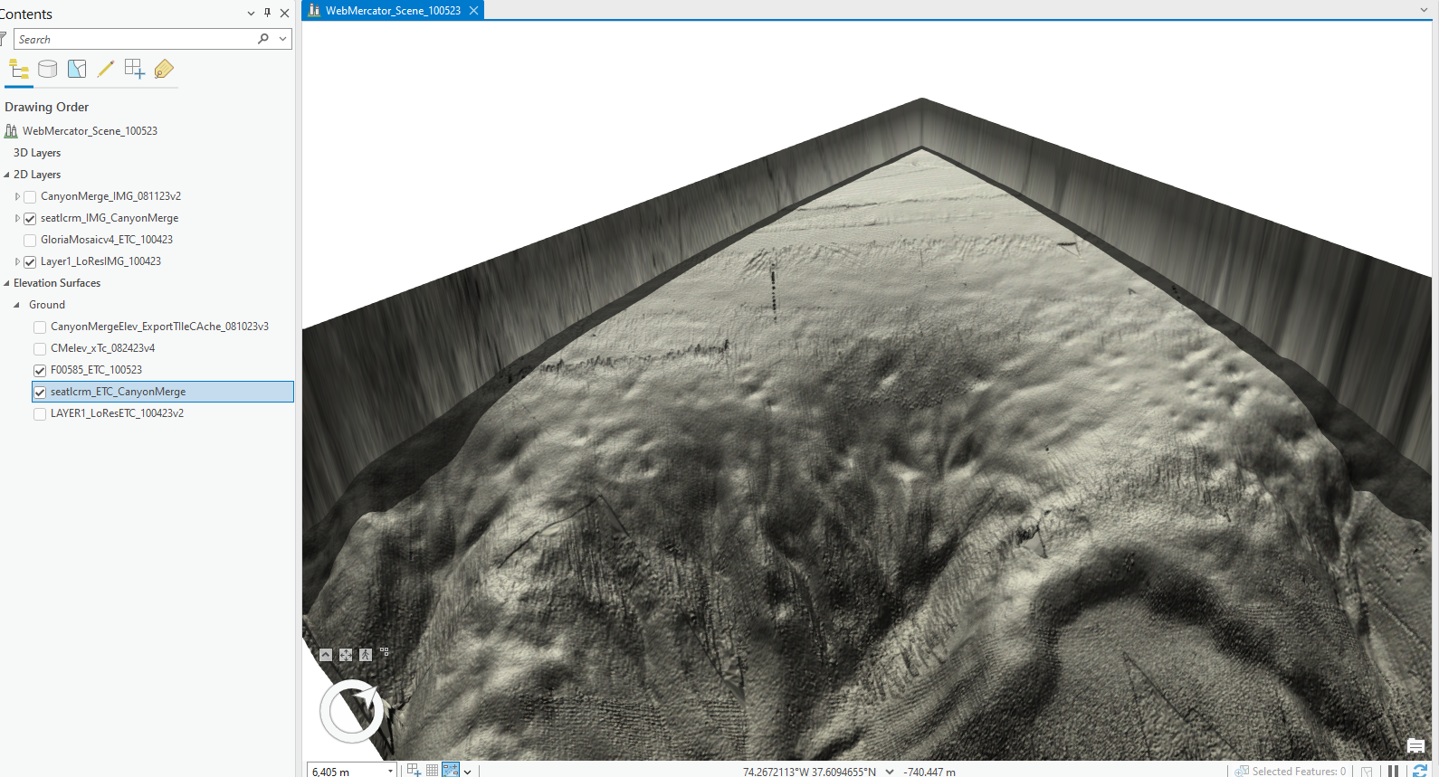
Image 1c - 4089m above terrain, more tiles missing, some show back up.
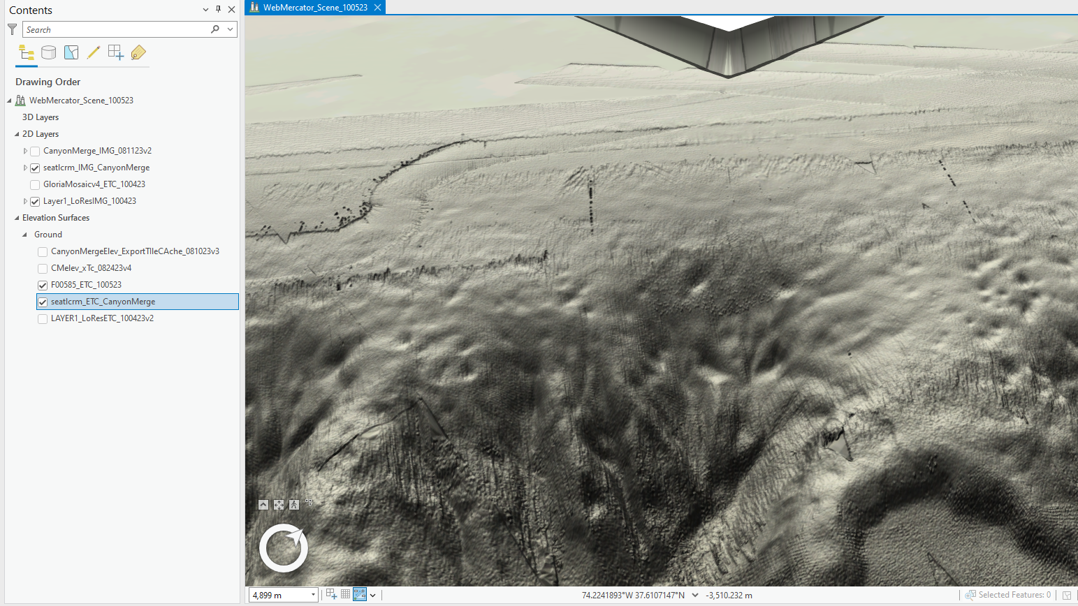
Image 2a - 4764m above terrain, shot taken over seemingly stable area of model.
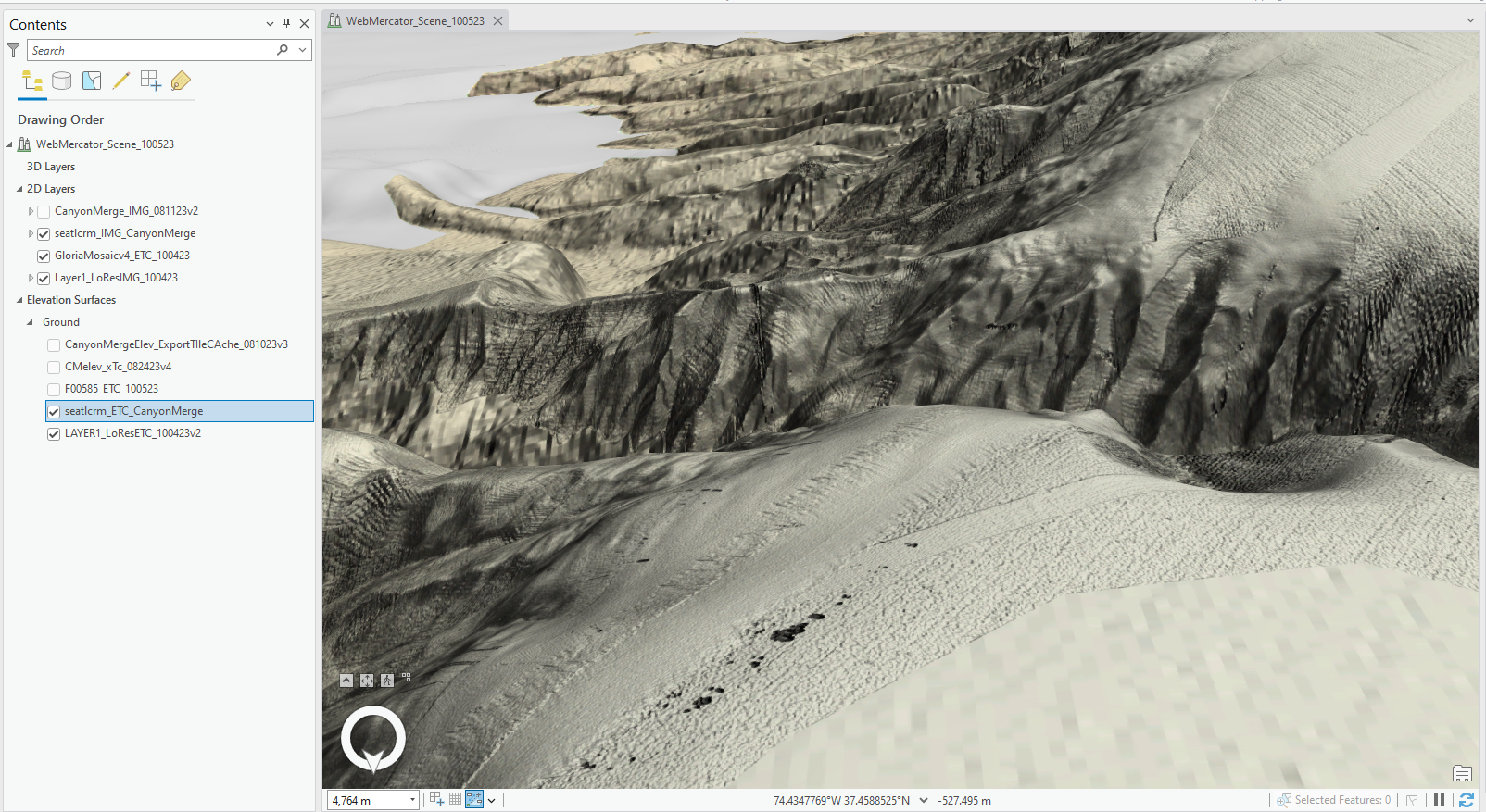
Image 2b - 4279m above terrain - zoom in a few hundred meters and the entire area in focus show many missing tiles and walls shoot up everywhere.
Thanks for any feedback.
Matt




