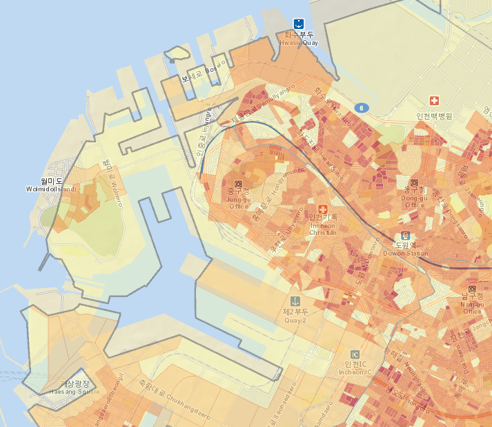
I am using ESRI demographic data for South Korea (specifically population density) and it appears that the geometries are offset when viewed against the base layer. Can anyone confirm this? See graphic below as an example. Just to be clear the image below is taken from ArcGIS Online and is only using ESRI data.
Les membres connectés peuvent publier, suivre les mises à jour, et plus encore. Nouveau ici ? Inscrivez-vous gratuitement.
Find useful guides, FAQs, and documents to help you navigate and make the most of Esri Community.