Dear esri community,
may I ask for your hepl, please?
I am preparing a map, drawn in UTM. However, in layout graticule grid labels for WGS84 shall be presented in this format: 51° 37.535'N 01° 26.206'E
With the following tags the result is like this: 51°37.535' N 001°26.206' E
<dyn type="grid" units="ddm" padDegrees="True" padMinutes="True" showZeroMinutes="true" zeroPad="true" decimalPlaces="3" directionSeparator = " "/>
Is there any way to remove one of the leading zero of Longitude degree?
(001°26.206' E to 01°26.206' E)
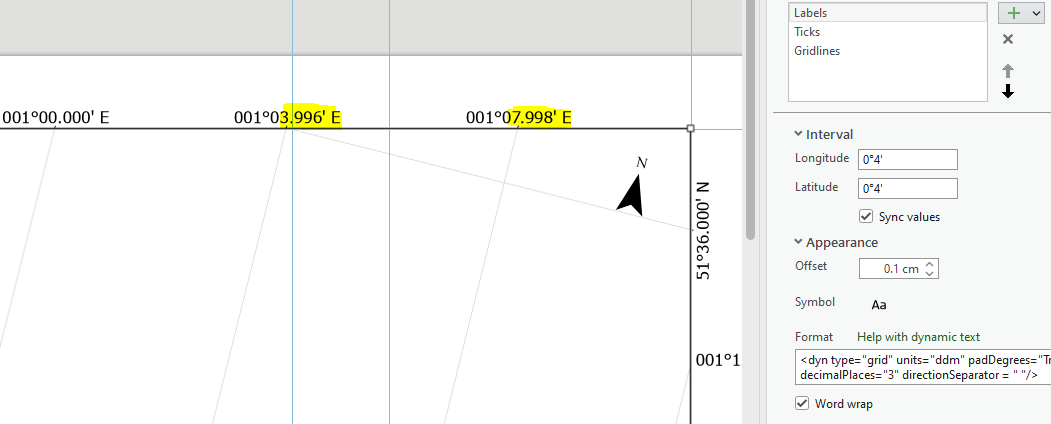
Secondly, I noticed a strange behaviour for the interval. For the requested scale I would say, it is not required to show decimal places of minutes, as the interval is 4 minutes. However, with all these decimal places I now see the following:
Expected: 001°00.000' E 001°04.000' E 001°08.000' E
Drawn: 001°00.000' E 001°03.996' E 001°07.998' E
If anyone has an idea what could be the reason for this (and how to change it to full 4 minute intervals), I would be very grateful.
Thank you very much in advance and best regards,
Claudia