Hi All,
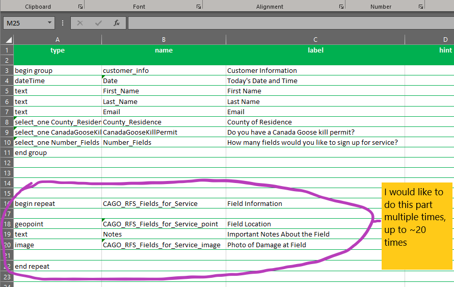
I am working on a public facing project where users sign up an agriculture field for service. The customer information is held in a table that is related to an agriculture field point layer. My idea is for the customer to use Survey123 to fill out their information and then place a point on the map for each agricultural field they would like to sign up for service. Each point would have notes and an image attachment associated with it. I am trying to do this in Survey123 but having a hard time pulling it off using repeats. Does anyone have any ideas how I can make this work?
Alternatively, I started working on this project using a public facing Field Map. My problem there was I could not figure out how to set up the map to make the entries only visible by the individual entering the information. For example, I don't want other folks using the Field Map to be able to see all the agricultural fields signed up for service.
Any suggestions would be very helpful, thank you!
-Jim



