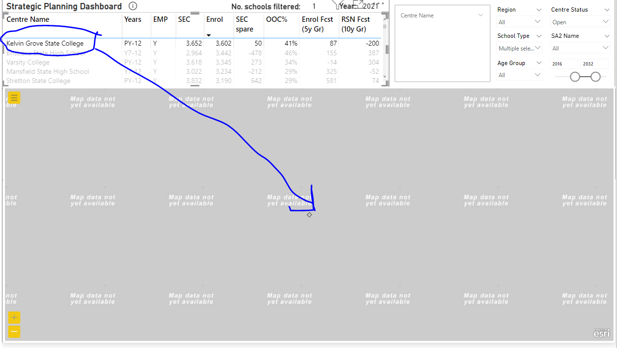
When filtering a single data point (Long, Lats) in Power bi, the Esri extension map zooms to close for the base maps to show. I would like to be able set the minimum automatic zoom limit as I am working at 1:2000 level.
I believe a number of users would be facing this same problem and would like to set the minimum and max level and let the automatic zoom do its thing.
See https://community.esri.com/t5/arcgis-for-power-bi-questions/arcgis-for-power-bi-zooms-in-too-close/m-p/1135264#M1067 for further details.
Hello,I have the same problem on my arcgis map on Power BI with I put the latitude and the longitude.
I do not have this problem when I put the name of the countries in the location.
But if I do that I can't share my dashboard...
So, is it possible to add an option to have a zoom level by default ? This way we can work with latitude and longitude easily.
Thanks
The only way I have found to fix the issue of zooming too close is to duplicate the points and offset the Long Lats so there are more then one point to zoom to. I then make the duplicate points transparent so you dont see them on the map.
Connectez-vous pour publier, suivre du contenu, et plus encore. Nouveau ici ? Inscrivez-vous gratuitement.