Hi All
I have created an mmpk of a certain area of my state with some wetlands for context and added it to the media folder in survey123 connect. It published and downloaded to the device without any issue.
I can click on the map in the geoshape question and zoom in to draw an area for capture
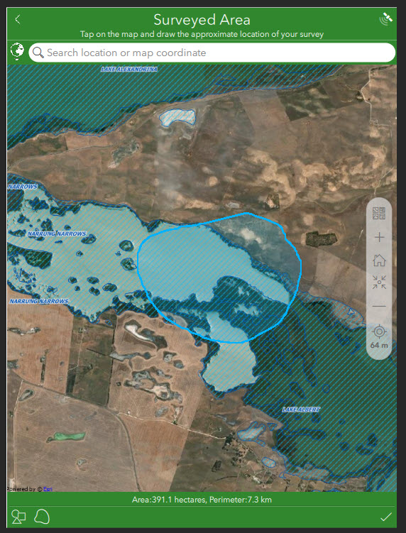
However after I click on the tick/OK the map reverts back to the full extent in the geoshape question
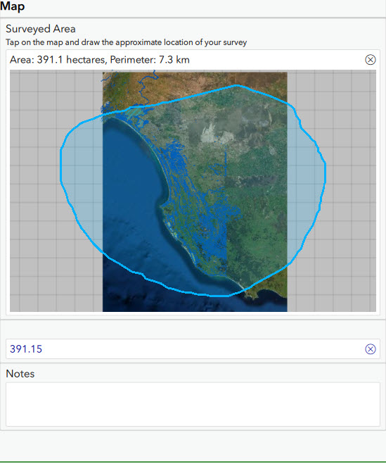
The geometry, extent and area still seem ok ...but it look weird in relation to the full extent of the map.
If I click back on the geoshape question the map displays correctly as per the first image, Its just seems to be the preview/display thats not right
Any ideas on whats happening here?
Cheers
Chris

