Hello everyone,
I have a question and it would really help me if someone could guide me in the right direction. For an analysis in ArcGIS Pro, I need to determine the parallel length between two lines. For the basic approach, I need two distances and one length:
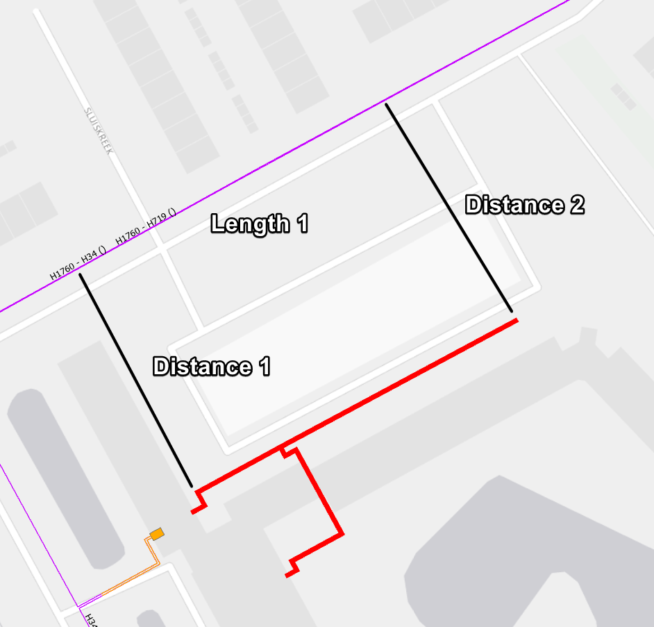
Is there any Tool which can help me with this? Or how would you try to get these results?
There is also a more detailed approach for when the geometry is a bit more messy:
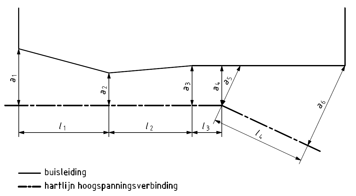
Here you can see that the individual segments are measured. It would be amazing if I could find/make a tool that outputs all the required data. For the visual aspect, I'm also looking for a way to get ArcGIS Pro to draw the a1/a2/... and l1, l2/... lines which I can symbolize as dimensions and label with the Shape_length.
In short:
- Is there a tool which I can use to get the basic parallel results from image 1?
- If 1. is a no, how could I make such a tool?
- Is there a tool which I can use to get the detailed parallel results from image 2?
- If 2. is a no, how could I make such a tool?
Thank you for reading this, I hope anyone knows anything which can help me start this task! 😀


