Hello everyone,
I have the following challenge; I am constructing an electrification system on a railway station and I need to convert the map of a large complex station with multiple tracks and geo featurelayers into a visual diagram.
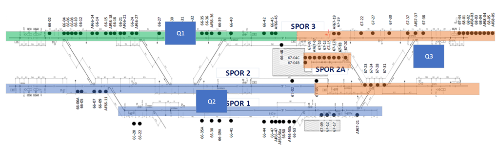
We want to be able to get an overview over the entire train station and each track, to clearly communicate where our different track possessions are in relation to the work that must be performed. Somehow, we want to convert illustration 1 into illustration 2.
Has anyone been in a similar situation and discovered a suitable way to handle this in ArcGIS Pro? I have heard some suggestions that it could be done with the Utility Network Extension, but nothing confirmed.
Is there perhaps a way to manually distort a map, so that you could drag/stretch/compress it into a desired shape, while retaining the geographical data (this case, the tracks, and positions)?
Thank you very much in advance,
Nikolaj
Illustration 1 : Train station with 3 - 4 tracks, about 2 km in length:
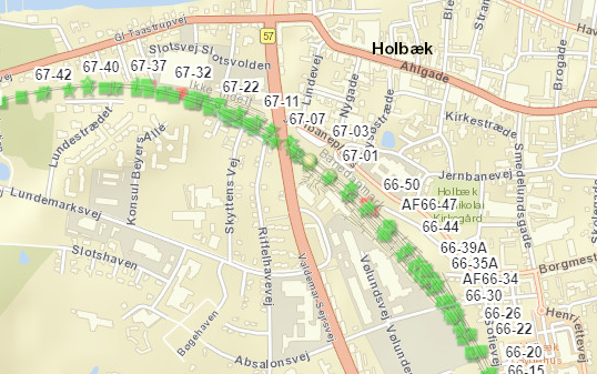
Illustration 2 : Desired Outcome (approximative illustration)